Freigné
Freigné | |
|---|---|
Part of Vallons-de-l'Erdre | |
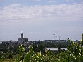 A general view of Freigné | |
 Coat of arms | |
show Location of Freigné | |
 Freigné | |
| Coordinates: 47°32′57″N 1°07′16″W / 47.5492°N 1.1211°WCoordinates: 47°32′57″N 1°07′16″W / 47.5492°N 1.1211°W | |
| Country | France |
| Region | Pays de la Loire |
| Department | Loire-Atlantique |
| Arrondissement | Châteaubriant-Ancenis |
| Canton | Ancenis |
| Commune | Vallons-de-l'Erdre |
| Area 1 | 65.26 km2 (25.20 sq mi) |
| Population (2017)[1] | 1,106 |
| • Density | 17/km2 (44/sq mi) |
| Demonym(s) | Freignéen, Freignéenne |
| Time zone | UTC+01:00 (CET) |
| • Summer (DST) | UTC+02:00 (CEST) |
| Postal code | 49440 |
| Elevation | 27–85 m (89–279 ft) (avg. 52 m or 171 ft) |
| 1 French Land Register data, which excludes lakes, ponds, glaciers > 1 km2 (0.386 sq mi or 247 acres) and river estuaries. | |


Freigné is a former commune in the Loire-Atlantique department in western France. Before 1 January 2018, it was part of the Maine-et-Loire department.[2] On 1 January 2018, it was merged into the new commune of Vallons-de-l'Erdre.[3]
References[]
- ^ Téléchargement du fichier d'ensemble des populations légales en 2017, INSEE
- ^ Décret n° 2017-1757 26 December 2017 (in French)
- ^ Arrêté préfectoral 29 December 2017 (in French)
| Wikimedia Commons has media related to Freigné. |
| Authority control |
|
|---|
This Loire-Atlantique geographical article is a stub. You can help Wikipedia by . |
Categories:
- Former communes of Maine-et-Loire
- Geography of Loire-Atlantique
- Populated places disestablished in 2018
- Loire-Atlantique geography stubs