Gabalfa
Gabalfa
| |
|---|---|
 St Marks Church, Gabalfa | |
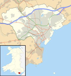 Gabalfa Location within Cardiff | |
| Population | 8,790 (2011)[1] |
| Principal area | |
| Ceremonial county | |
| Country | Wales |
| Sovereign state | United Kingdom |
| Post town | CARDIFF |
| Postcode district | CF14 |
| Dialling code | +44-29 |
| Police | South Wales |
| Fire | South Wales |
| Ambulance | Welsh |
| UK Parliament | |
| Senedd Cymru – Welsh Parliament |
|

Gabalfa (English: /ɡəˈbælvə/, Welsh pronunciation: [ɡaˈbalva]) is a district and community in the north of the city of Cardiff, capital of Wales. It is characterised by a four-lane fly over road at the Gabalfa Interchange, where the A48 road meets the A470 road (North Road) which leads from Cardiff to northern Wales, and the A469 road (Caerphilly Road).
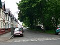
The name is derived from the Welsh 'Ceubalfa', which is literally translated as 'place of the boat'. It was formerly the site of a ferry crossing across the River Taff, upon which a school is now built.[2] The area was first heavily developed in the 1880s, with most of the characteristic terraced housing originating from the next 30 years of construction.[3]
The area around St. Joseph's Church near to Companies House is known as 'the Colonies' due to the number of street names after former British colonies, including Australia Road, Newfoundland Road and many more.
Education[]

Primary[]
Gabalfa has three primary schools, with a combined attendance of more than 720:
- St. Joseph's (Roman Catholic) Primary School[4][5]
- Allensbank Primary School[6]
- Ysgol Mynydd Bychan ('Heath School' in Welsh),[7] which teaches in the Welsh medium.
Gabalfa Primary school is not within modern Gabalfa but is in neighbouring Llandaff North.
Secondary[]
Gabalfa has one secondary school, Cathays High School,[8] which serves around 900 students[9] (mainly from outside Gabalfa)
University[]
Gabalfa has a high student population. Several halls of residence for Cardiff University are in Gabalfa, housing about 3,100 students, around 10% of the student body.[10][11][12][13] Liberty House[14] serves mainly medical and nursing students at the nearly University Hospital of Wales. In addition, many students live in privately-rented accommodation in the area.
Places of worship[]

Churches in Gabalfa include St Mark's on North Road (Church in Wales),[15] St Joseph's on New Zealand Road (Roman Catholic),[16] and the All Nations Church on Eastern Avenue (colocated with the All Nations Centre).
Politics[]

The electoral ward of Gabalfa lies within the parliamentary constituency of Cardiff North, which has been represented since 2017 by Welsh Labour MP Anna McMorrin. In the Senedd, Cardiff North is represented by Welsh Labour MS Julie Morgan.
There is no community council for the area. Gabalfa was served by two councillors: Ed Bridges (Liberal Democrat), elected in 2004, and Gareth Holden, elected in 2012. Holden was elected as a Liberal Democrat but resigned from the party in 2013.[17] He lost out to a Liberal Democrat candidate in the May 2017 election. The ward is currently served by Rhys Taylor and Ashley Wood (2019).
It is bounded by Birchgrove and Heath to the north, Cathays and Maindy to the south, and Llandaff North to the northwest.
Transport[]
The area is known for the Gabalfa Interchange (or Gabalfa flyover), where the A48 Eastern Avenue, A470 North Road, and the A469 Whitchurch Road (south)/Caerphilly Road (north) meet. Sadly, the interchange is known for its suicides and suicide attempts,[18][19] although efforts have been made to improve this, with signs to suicide prevention charities now clearly visible on the pedestrian bridge over Eastern Avenue.
Bus[]
Cardiff Bus' service 35 bus circles the area before heading to Cardiff Bay via Cathays and Central station. Services 1/2 Bay Circle run along Western Avenue towards Heath or Llandaff. Additionally, the following services stop at the Gabalfa Interchange:[20]
- 8 (University Hospital of Wales) or (Cathays-Roath-Central Station-Grangetown-Cardiff Bay)
- 9 (University Hospital of Wales) or (International Sports Village)
- 21 (Rhiwbina-Coryton-Whitchurch) or (Central Stn)
- 23 (Whitchurch-Coryton-Rhiwbina) or (Central Stn)
- 24 (Whitchurch-Llandaff North-Pontcanna-Llandaff)
- 25 (Central Stn)
- 27 Capital City Green (Heath-Birchgrove-Thornhill) or (Central Stn)
- 35 (Gabalfa) or (Cathays-Central Stn-Cardiff Bay)
Rail[]
There are no railway stations located within Gabalfa, although a new railway station serving the ward was proposed by the County Council in 2000.[21] The nearest railway stations are Heath Low Level and Heath High Level to the north-west, Cathays to the south and Llandaf railway station to the north-east.
Walking and Cycling[]
The Taff Trail long-distance footpath and cycle route runs along the River Taff, and is connected to Gabalfa by Llys Tal-y-Bont Road. As of 2019 Cardiff council has plans to build Cycleway 1 along Allensbank Road on the edge of the area.[22] To promote cycling and improve safety, in recent years councillors and residents have campaigned with some success for traffic calming measures, such as Gabalfa becoming a 20 mile per hour zone, raised crossings being installed,[23][24] and curbs being narrowed.
Gabalfa is within a 30 minute walk or a 10 minute cycle of the city centre.[citation needed]
Gallery[]
Africa Gardens

Part of the Gabalfa Interchange and flyover

Subway under Gabalfa Interchange


References[]
- ^ "Ward population 2011". Retrieved 8 April 2015.
- ^ "BBC - South East Wales Streets of Cardiff - Gabalfa". Retrieved 16 January 2008.
- ^ "www.cardiffmuseum.co.uk gabalfa". www.thecardiffmuseum.co.uk. Retrieved 22 August 2019.
- ^ "St Joseph's R.C. Primary School, Cardiff". The Good Schools Guide. Retrieved 21 August 2019.
- ^ "St Joseph's R.C. Primary School | Estyn". www.estyn.gov.wales. Retrieved 21 August 2019.
- ^ "Allensbank Primary School | Estyn". www.estyn.llyw.cymru. Retrieved 21 August 2019.
- ^ "Ysgol Mynydd Bychan". Inspection Reports. 21 August 2019. Retrieved 21 August 2019.
- ^ "Cathays High School". www.estyn.gov.wales. 21 August 2019. Retrieved 21 August 2019.
- ^ "A report on Cathays High School" (PDF). Cathays High School. 1 February 2013. Retrieved 22 August 2019.
- ^ "Talybont North". Cardiff University. Retrieved 21 August 2019.
- ^ "Talybont South". Cardiff University. Retrieved 21 August 2019.
- ^ "Talybont Gate". Cardiff University. Retrieved 22 August 2019.
- ^ "Talybont Court". Cardiff University. Retrieved 22 August 2019.
- ^ "Liberty House". Cardiff University. Retrieved 21 August 2019.
- ^ "Who we are". St Mark's Church
- ^ "Contact Detail". Saint Joseph's R.C. Parish, Cardiff. Retrieved 28 August 2019.
- ^ Peter Law (21 January 2013). "Lib Dem councillor leaves party in anger at coalition government". Wales Online. Retrieved 20 April 2018.
- ^ Melville-Smith, Alicia (3 August 2015). "Major Cardiff road reopens after man dies falling from flyover". walesonline. Retrieved 21 August 2019.
- ^ "Body of a man discovered on A48 Western Avenue in Cardiff". The Independent. 3 August 2015. Retrieved 21 August 2019.
- ^ "Routes & Maps - Cardiff Bus". www.cardiffbus.com. Retrieved 21 August 2019.
- ^ "Cardiff County Council - Local Transport Plan 2000-2016". Cardiff County Council. 1 August 2000. Archived from the original (PDF) on 26 September 2007. Retrieved 17 January 2008.
- ^ Discombe, Matt (13 March 2019). "Cardiff's first segregated cycleway to be built — and there'll be more to come". Wales Online. Retrieved 17 January 2020.
- ^ "Clodien Avenue Area Traffic Calming" (PDF). Clodien Avenue Area Traffic Calming. 21 August 2019. Retrieved 21 August 2019.
- ^ "Whichurch Road/ Flaxland Avenue Pedestrian Crossing Facilities" (PDF). 21 August 2019. Retrieved 21 August 2019.
External links[]
| Wikimedia Commons has media related to Gabalfa. |
- Communities in Cardiff
- Politics of Cardiff
- Districts of Cardiff
- Cardiff electoral wards