Galeana, Nuevo León
Galeana | |
|---|---|
| Motto(s): Labor Omnia Vinat | |
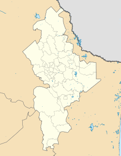 Galeana Location | |
| Coordinates: 24°50′N 100°04′W / 24.833°N 100.067°WCoordinates: 24°50′N 100°04′W / 24.833°N 100.067°W | |
| Country | |
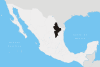
| State | Nuevo León |
| Founded | 1678 |
| Government | |
| • Mayor | Alejandro Javier Pedro Flores (PRI) |
| Area | |
| • Total | 7,154.6 km2 (2,762.4 sq mi) |
| Elevation | 1,655 m (5,430 ft) |
| Population (2005) | |
| • Total | 38,930 |
| • Density | 0.18/km2 (0.5/sq mi) |
| Time zone | UTC-6 (Central Standard Time) |
| • Summer (DST) | UTC-5 (Central Daylight Time) |
| Website | http://www.galeana.gob.mx |


Galeana is both a municipality and a city in the Mexican state of Nuevo León. It is named after Hermenegildo Galeana, a lieutenant involved in the country's movement towards independence. Galeana shares borders with the states of Coahuila, San Luis Potosí and Zacatecas to the west; with the municipalities of Aramberri and Doctor Arroyo to the south; Rayones to the north; and with Linares, Montemorelos, Rayones and Iturbide to the east.[1] Galeana is the largest municipality in the state, totaling 7,154.6 km², however it's scarcely populated with only 38,930 inhabitants[2] resulting in a population density of 0.18 persons per square kilometer. Galeana, the municipal seat, is the best developed town in the region. It has services such as hospitals, accommodations, restaurants, bars and the largest drink distributor in the zone. However it remains as a low per-capita income city.
Climate[]
Climate in Galeana is usually much colder than the rest of the state. In summer it is pleasantly cool and during winter, temperatures may reach down to -9°C. Annual average temperature is 17°C, and the average rain precipitation is around 446 mm. The winter cold blends with a noticeable lack of air humidity. Predominants winds comes from the north.
| hideClimate data for Galeana, Nuevo Leon, 1981-2010 normals, extremes 1974-present | |||||||||||||
|---|---|---|---|---|---|---|---|---|---|---|---|---|---|
| Month | Jan | Feb | Mar | Apr | May | Jun | Jul | Aug | Sep | Oct | Nov | Dec | Year |
| Record high °F (°C) | 86 (30) |
90 (32) |
100 (38) |
97 (36) |
102 (39) |
104 (40) |
99 (37) |
97 (36) |
91 (33) |
90 (32) |
93 (34) |
91 (33) |
104 (40) |
| Average high °F (°C) | 67.5 (19.7) |
70.7 (21.5) |
74.3 (23.5) |
78.6 (25.9) |
82.2 (27.9) |
82.2 (27.9) |
82.0 (27.8) |
81.1 (27.3) |
76.6 (24.8) |
72.5 (22.5) |
70.7 (21.5) |
68.4 (20.2) |
75.6 (24.2) |
| Average low °F (°C) | 42.3 (5.7) |
44.4 (6.9) |
47.5 (8.6) |
50.7 (10.4) |
54.9 (12.7) |
57.2 (14.0) |
57.0 (13.9) |
56.1 (13.4) |
54.1 (12.3) |
48.4 (9.1) |
45.9 (7.7) |
42.3 (5.7) |
50.1 (10.0) |
| Record low °F (°C) | 16 (−9) |
19 (−7) |
23 (−5) |
32 (0) |
36 (2) |
41 (5) |
37 (3) |
43 (6) |
23 (−5) |
32 (0) |
23 (−5) |
18 (−8) |
16 (−9) |
| Average precipitation inches (mm) | 0.86 (21.8) |
0.32 (8.2) |
0.38 (9.7) |
1.05 (26.7) |
1.82 (46.2) |
2.46 (62.6) |
2.27 (57.7) |
2.65 (67.2) |
3.26 (82.9) |
1.66 (42.1) |
0.31 (7.8) |
0.52 (13.2) |
17.56 (446.1) |
| Average rainy days (≥ 1 mm) | 2.6 | 1.6 | 1.7 | 3.5 | 5.6 | 6.6 | 6.8 | 6.1 | 7.0 | 4.2 | 1.4 | 1.7 | 48.8 |
| Source: [1] | |||||||||||||
Crops[]
The main crop in Galeana is the potato, which is exported to different states and is also internationally shipped.
Tourist attractions[]

The municipality is known for its numerous tourist attractions. Probably the best known attraction is the Cerro del Potosí (Potosi's Mount), the highest mountain in the whole state, which rises over 3,600 meters above sea level. On the Rayones-Galeana highway lies El Puente de Dios (God's Bridge), a majestic natural archway that lies on top of a small creek. El Pozo del Gavilán is an enormous, deep natural cenote, where diverse species live. The Laguna de Labradores, in the capital, is a small lake connected to the Pozo del Gavilán.
References[]
- ^ ""Galeana", Enciclopedia de los Municipios de México". Archived from the original on 2007-02-08. Retrieved 2007-03-29.
- ^ "INEGI Información Municipal". Archived from the original on 2007-02-20. Retrieved 2007-03-29.
| show |
|---|
- Municipalities of Nuevo León
- Populated places in Nuevo León