Gdyel
Gdyel | |
|---|---|
Commune and town | |
 | |
 Gdyel | |
| Coordinates: 35°46′56″N 0°25′25″W / 35.782171°N 0.423746°W | |
| Country | |
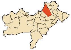
| Province | Oran Province |
| District | Gdyel District |
| Area | |
| • Total | 36.22 sq mi (93.82 km2) |
| Population (2009) | |
| • Total | 39,129 |
| Time zone | UTC+1 (CET) |

Gdyel (Arabic: قديل), former Saint-Cloud, is a town and commune in District Gdyel, Oran Province, Algeria, about 15 miles to the east of Oran. Under French rule, it was the centre of a wine-growing district and was called St. Cloud.
According to the 1998 census it has a population of 29 999.[1]
When the Americans invaded Algeria in November 1942 (Operation Torch), the troops who landed at , between Arzew and (now called Bethioua) were held up for two days by fierce fighting at St. Cloud. Eventually, the town was simply by-passed by Major-General Terry de La Mesa Allen, which surprised the defenders of Oran, who quickly surrendered.[2]
References[]
| Oran District |  | |
|---|---|---|
| Aïn El Turk District | ||
| Arzew District | ||
| Bethioua District | ||
| Es Sénia District | ||
| Bir El Djir District | ||
| Boutlélis District | ||
| Oued Tlélat District | ||
| Gdyel District | ||
Coordinates: 35°47′N 0°26′W / 35.783°N 0.433°W
{{ar:قديل}} {{fr:Gdyel}}
This article about a location in Oran Province is a stub. You can help Wikipedia by . |
- Communes of Oran Province
- Oranais geography stubs