Gdynia-Kosakowo Airport
Gdynia-Kosakowo Airport Port Lotniczy Gdynia-Kosakowo | |||||||||||
|---|---|---|---|---|---|---|---|---|---|---|---|
 | |||||||||||
| Summary | |||||||||||
| Airport type | Public | ||||||||||
| Serves | Gdynia, Poland | ||||||||||
| Elevation AMSL | 148 ft / 45 m | ||||||||||
| Coordinates | 54°34′47″N 18°31′02″E / 54.57972°N 18.51722°ECoordinates: 54°34′47″N 18°31′02″E / 54.57972°N 18.51722°E | ||||||||||
| Website | www.airport.gdynia.pl/ | ||||||||||
| Map | |||||||||||
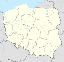 Gdynia Location of airport in Poland | |||||||||||
| Runways | |||||||||||
| |||||||||||
| Statistics (2007 +/- change from 2006) | |||||||||||
| |||||||||||

Airport Gdynia-Kosakowo (also known as Gdynia-Oksywie, Gdynia-Babie Doły) is a civil (under construction) and military airport in northern Poland.
The governing authority of the city of Gdynia is building this airport as a secondary choice to the main airport at Rebiechowo, near Gdansk, which allows another economic boost to the area.
History[]
The airport opened before 1939. 1 May 1935 was the official opening date for the Gdynia- Rumia Zagórze passenger airport. There were daily flights to Warsaw, Cracow, Copenhagen, Venice, Rome, Milano, Budapest.
Airport infrastructure[]
There exists a railroad line next to the terminal that can be used for passenger service. Pomorska Kolej Metropolitalna company was created to introduce the rail link.
References[]
External links[]
| Wikimedia Commons has media related to Gdynia-Kosakowo Airport. |
This article about an airport in Poland is a stub. You can help Wikipedia by . |
- Airports in Poland
- Buildings and structures in Gdynia
- European airport stubs
- Polish building and structure stubs
- Poland transport stubs