Geishouse
Geishouse | |
|---|---|
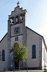 The church in Geishouse | |
 Coat of arms | |
show Location of Geishouse | |
 Geishouse | |
| Coordinates: 47°53′02″N 7°03′39″E / 47.8839°N 7.0608°ECoordinates: 47°53′02″N 7°03′39″E / 47.8839°N 7.0608°E | |
| Country | France |
| Region | Grand Est |
| Department | Haut-Rhin |
| Arrondissement | Thann-Guebwiller |
| Canton | Cernay |
| Intercommunality | Vallée de Saint-Amarin |
| Government | |
| • Mayor (2020–2026) | Claude Kirchhoffer[1] |
| Area 1 | 7.28 km2 (2.81 sq mi) |
| Population (Jan. 2018)[2] | 440 |
| • Density | 60/km2 (160/sq mi) |
| Time zone | UTC+01:00 (CET) |
| • Summer (DST) | UTC+02:00 (CEST) |
| INSEE/Postal code | 68102 /68690 |
| Elevation | 510–1,422 m (1,673–4,665 ft) (avg. 730 m or 2,400 ft) |
| 1 French Land Register data, which excludes lakes, ponds, glaciers > 1 km2 (0.386 sq mi or 247 acres) and river estuaries. | |


Geishouse (German: Geishausen) is a commune in the Haut-Rhin department in Grand Est in north-eastern France.
See also[]
References[]
- ^ "Répertoire national des élus: les maires". data.gouv.fr, Plateforme ouverte des données publiques françaises (in French). 2 December 2020.
- ^ "Populations légales 2018". INSEE. 28 December 2020.
| Wikimedia Commons has media related to Geishouse. |
This Haut-Rhin geographical article is a stub. You can help Wikipedia by . |
Categories:
- Communes of Haut-Rhin
- Haut-Rhin geography stubs