Geumseong-dong
This article needs additional citations for verification. (April 2015) |
Geumseong | |
|---|---|
| Korean transcription(s) | |
| • Hangul | 금성 |
| • Hanja | 金城 |
| • Revised Romanization | Geumseong |
| • McCune–Reischauer | Kŭmsŏng |
 A view of the village of Sanseong, looking south towards Pari-bong. | |
 | |
| Country | South Korea |
| Administrative divisions | 1 administrative dong |
| Area | |
| • Total | 8.41 km2 (3.25 sq mi) |
| Population (2011) | |
| • Total | 1,211 |
| • Density | 144/km2 (370/sq mi) |
Geumseong is a dong, or precinct, in Geumjeong-gu, Busan, South Korea. A lightly populated district, it is situated entirely within the mountain range of Geumjeongsan. It is bounded to the west by Hwamyeong-dong and in Buk District, to the northwest by Dong-myeon of Yangsan City, to the east by , Namsan-dong, Guseo-dong, and Jangjeon-dong of Geumjeong-gu, and to the south by in Dongnae-gu. The northernmost point in Geumseong-dong is at , the highest peak in Geumjeongsan.
Geumseong-dong is a rural district connected by public transit to the rest of Busan by bus service only. Despite covering a comparatively large area, Geumseong-dong is not subdivided into additional "administrative dong" due to its low population. There are two points of access to the dong where the main road, Sanseong-ro, connects to Hwamyeong-dong in the west, and Jangjeon-dong in the east. The only major area of settlement within the dong is in the village of Sanseong-myeon (literally "mountain fortress village").
The name Geumseong derives from Geumjeongsanseong, a large mountain fortress built in 1703 that is located largely within the dong.
See also[]
References[]
"금정구청 영문". Busan Metropolitan City Geumjeong-gu. 2009. Archived from the original on 2015-05-28. Retrieved 2015-03-10.
| Administrative dong | 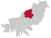 | |
|---|---|---|
Coordinates: 35°15′12″N 129°3′23″E / 35.25333°N 129.05639°E

- Geumjeong District
- Neighbourhoods in Busan