Ghatigaon
Ghatigaon
Ghātīgaon | |
|---|---|
Village | |
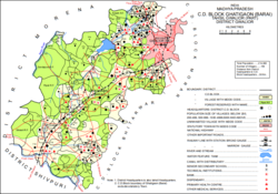 Map of Ghatigaon CD block | |
 Ghatigaon Location in Madhya Pradesh, India | |
| Coordinates: 26°03′12″N 77°56′10″E / 26.053327°N 77.936016°ECoordinates: 26°03′12″N 77°56′10″E / 26.053327°N 77.936016°E[1] | |
| Country | |
| State | Madhya Pradesh |
| District | Gwalior |
| Area | |
| • Total | 18.601 km2 (7.182 sq mi) |
| Population (2011)[2] | |
| • Total | 5,641 |
| • Density | 300/km2 (790/sq mi) |
| Languages | |
| • Official | Hindi |
| Time zone | UTC+5:30 (IST) |


Ghatigaon (Devanagari: घाटीगांव Gháṭígaon)[3] is a village and corresponding community development block in Gwalior district of Madhya Pradesh, India.[2] As of 2011, the village population is 5,641, in 1,088 households.[2]
History[]
Ghatigaon is mentioned in the 1908 British gazetteer as a village of Gwalior State, in pargana of zila Gird Gwalior, with an area of 10,703 bighas and a population of 679.[3] It had a camping ground, a Dak bungalow, an , metalled road access, a state post office, a railway station, and a .[3]
Villages[]
Ghatigaon CD block has the following 159 villages:[2]
| Village name | Total land area (hectares) | Population (in 2011) |
|---|---|---|
| 919.9 | 352 | |
| 1,744.6 | 355 | |
| 1,396.6 | 327 | |
| 4,350.4 | 149 | |
| 779.1 | 381 | |
| 980.4 | 652 | |
| 852.2 | 225 | |
| 897.5 | 331 | |
| Antri | 1,000.4 | 338 |
| 79.6 | 111 | |
| 503.4 | 388 | |
| 7,919 | 4,202 | |
| 2,529.8 | 747 | |
| 1,211.7 | 851 | |
| 3,340.7 | 700 | |
| 673.6 | 595 | |
| 4,345.8 | 0 | |
| 1,248.1 | 458 | |
| 1,699.1 | 2,045 | |
| 330.3 | 46 | |
| 2,547.5 | 3,298 | |
| 617.1 | 104 | |
| 4,157.7 | 18,542 | |
| 209.4 | 220 | |
| 289.4 | 168 | |
| 658.2 | 0 | |
| 1,520.5 | 3,370 | |
| 154.2 | 101 | |
| 317.6 | 1,009 | |
| 260.2 | 0 | |
| 146.8 | 0 | |
| 965.5 | 776 | |
| 311.9 | 0 | |
| 1,191.7 | 2,104 | |
| 954.6 | 537 | |
| 805.3 | 270 | |
| 1,235.8 | 267 | |
| 401.4 | 0 | |
| 1,905 | 0 | |
| 1,001.8 | 2,972 | |
| 104 | 700 | |
| 106.3 | 0 | |
| 185.5 | 1,923 | |
| 1,011 | 0 | |
| 2,490.4 | 0 | |
| 769 | 974 | |
| 185.5 | 0 | |
| 813.8 | 0 | |
| 365.4 | 557 | |
| 294.7 | 0 | |
| 237.6 | 0 | |
| 920.8 | 0 | |
| 1,077.4 | 0 | |
| 759.8 | 0 | |
| 1,256.7 | 164 | |
| 173 | 532 | |
| 279.5 | 1,428 | |
| 452.2 | 392 | |
| 343.5 | 1,067 | |
| 524.6 | 1 | |
| 405.4 | 773 | |
| 6,621.5 | 4,268 | |
| 164.6 | 0 | |
| 1,261.8 | 2,054 | |
| 524.6 | 162 | |
| 91.6 | 0 | |
| 785.4 | 903 | |
| 1,082.6 | 1,315 | |
| 1,304.6 | 861 | |
| 928.8 | 534 | |
| 313.4 | 0 | |
| 504.6 | 859 | |
| 2,057.3 | 1,042 | |
| Ghatigaon (Barai) | 1,860.1 | 5,641 |
| 3,835.9 | 329 | |
| 3,154.5 | 935 | |
| 2,546.1 | 631 | |
| 1,898.7 | 408 | |
| 1,284.3 | 300 | |
| 3,179.1 | 4 | |
| 421 | 343 | |
| 478.6 | 24 | |
| 415.5 | 37 | |
| 819.6 | 217 | |
| 685.8 | 855 | |
| 2,594.7 | 253 | |
| 5,303.4 | 8,302 | |
| 2,513.7 | 7,119 | |
| 1,994.4 | 2,699 | |
| 246.2 | 10 | |
| 582.5 | 494 | |
| 100.4 | 57 | |
| 388.9 | 988 | |
| 942.4 | 1,909 | |
| 150.2 | 0 | |
| 220.8 | 419 | |
| 647.4 | 8,328 | |
| 533.2 | 649 | |
| 1,112.6 | 2,847 | |
| 387.9 | 2,012 | |
| 110.3 | 517 | |
| 1,168.9 | 9,770 | |
| 97 | 6,140 | |
| 94 | 403 | |
| 171 | 921 | |
| 92 | 703 | |
| 778.5 | 1,390 | |
| 992.4 | 527 | |
| 150 | 12 | |
| 90.9 | 432 | |
| 910.4 | 80 | |
| 285.7 | 1,127 | |
| 1,997.1 | 5,383 | |
| 512.2 | 553 | |
| 154.3 | 630 | |
| 331.1 | 1,744 | |
| 165.2 | 388 | |
| 1,242.6 | 1,583 | |
| 163.8 | 926 | |
| 87.8 | 337 | |
| 852.3 | 3,371 | |
| 916.6 | 2,987 | |
| 193 | 738 | |
| 246 | 1,113 | |
| 723.1 | 1,732 | |
| 246.5 | 1,738 | |
| 223 | 844 | |
| 479.1 | 10,219 | |
| 393.1 | 1,503 | |
| 562.4 | 1,779 | |
| 409 | 2,224 | |
| 197.9 | 768 | |
| 140.1 | 465 | |
| 212.5 | 1,383 | |
| 253 | 1,207 | |
| 617.8 | 1,003 | |
| 794.4 | 2,147 | |
| 545.3 | 6,705 | |
| 67.8 | 678 | |
| 2.3 | 3 | |
| 15.1 | 10 | |
| 294.3 | 417 | |
| 322.7 | 1,100 | |
| 289 | 997 | |
| 479.5 | 333 | |
| 1098.7 | 1,099 | |
| 810.7 | 527 | |
| 1,256.5 | 698 | |
| 2,849 | 601 | |
| 1,819 | 1,273 | |
| 3,215.3 | 3,257 | |
| 3,215 | 423 | |
| 6,489.1 | 3,827 | |
| 0 | 1,328 | |
| 0 | 2,772 | |
| 1,645.2 | 2,002 | |
| 0 | 1,371 | |
| 2,202.8 | 990 | |
| 0 | 2,134 |
References[]
- ^ Search for "Ghatigaon" here https://geonames.nga.mil/namesgaz/. Missing or empty
|title=(help) - ^ a b c d e "Census of India 2011: Madhya Pradesh District Census Handbook - Gwalior, Part A (Village and Town Directory)" (PDF). Census 2011 India. pp. 83–145. Retrieved 8 May 2021.
- ^ a b c Luard, C.E.; Sheopuri, Dwarka Nath (1908). Gwalior State Gazetteer Vol. I, Part III: Village List. Lucknow: Newul Kishore Press. p. 6. Retrieved 10 May 2021.
Categories:
- Villages in Gwalior district