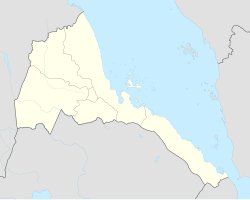
Ghinda
Ghinda
ጊንዳዕ | |
|---|---|
Town | |
 The Ghinda horizon. | |
 Ghinda Location in Eritrea | |
| Coordinates: 15°27′N 39°05′E / 15.450°N 39.083°ECoordinates: 15°27′N 39°05′E / 15.450°N 39.083°E | |
| Country | |
| Region | Northern Red Sea |
| District | Ghinda |
| Elevation | 928 m (3,045 ft) |
| Climate | Aw |
Ghinda (Tigrinya: ጊንዳዕ) is a town in the Northern Red Sea region of Eritrea. It is situated in the Ghinda Subregion, and lies between Asmara and Massawa.
Overview[]
Ghinda is a major fruit and vegetable growing area and a centre for Tigre Muslims and some Saho Muslims . It lies near the springs of . The citrus plantations were originally planted by , an Italian from Centenaro who directed the construction of the Eritrean Railway, the first railway in Italian Eritrea.
Climate[]
| hideClimate data for Ghinda | |||||||||||||
|---|---|---|---|---|---|---|---|---|---|---|---|---|---|
| Month | Jan | Feb | Mar | Apr | May | Jun | Jul | Aug | Sep | Oct | Nov | Dec | Year |
| Average high °C (°F) | 28.6 (83.5) |
29.4 (84.9) |
31.0 (87.8) |
32.3 (90.1) |
33.6 (92.5) |
34.5 (94.1) |
31.7 (89.1) |
31.1 (88.0) |
32.5 (90.5) |
31.3 (88.3) |
29.5 (85.1) |
28.4 (83.1) |
31.2 (88.1) |
| Average low °C (°F) | 14.5 (58.1) |
15.1 (59.2) |
16.3 (61.3) |
17.7 (63.9) |
19.0 (66.2) |
20.1 (68.2) |
19.7 (67.5) |
20.6 (69.1) |
19.2 (66.6) |
17.1 (62.8) |
15.2 (59.4) |
14.8 (58.6) |
17.4 (63.4) |
| Average precipitation mm (inches) | 99 (3.9) |
113 (4.4) |
72 (2.8) |
48 (1.9) |
26 (1.0) |
10 (0.4) |
71 (2.8) |
58 (2.3) |
23 (0.9) |
46 (1.8) |
52 (2.0) |
94 (3.7) |
712 (27.9) |
| Source: Climate Data | |||||||||||||
See also[]
- Railway stations in Eritrea
References[]
Categories:
- Northern Red Sea Region
- Populated places in Eritrea
- Eritrea geography stubs
