Giyani
hideThis article has multiple issues. Please help or discuss these issues on the talk page. (Learn how and when to remove these template messages)
|
Giyani | |
|---|---|
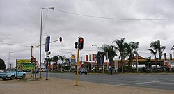 A traffic junction and shopping centre in central Giyani | |
 Giyani | |
| Coordinates: 23°18′36″S 30°42′23″E / 23.31000°S 30.70639°ECoordinates: 23°18′36″S 30°42′23″E / 23.31000°S 30.70639°E | |
| Country | South Africa |
| Province | Limpopo |
| District | Mopani |
| Municipality | Greater Giyani |
| Area | |
| • Total | 19.51 km2 (7.53 sq mi) |
| Population (2011)[1] | |
| • Total | 25,954 |
| • Density | 1,300/km2 (3,400/sq mi) |
| Racial makeup (2011) | |
| • Black African | 96.9% |
| • Coloured | 0.2% |
| • Indian/Asian | 2.0% |
| • White | 0.5% |
| • Other | 0.4% |
| First languages (2011) | |
| • XiTsonga | 91.8% |
| • English | 0.2% |
| • Northern Sotho | 2.7% |
| • TshiVenda | 1.4% |
| • Other | 6.2% |
| Time zone | UTC+2 (SAST) |
| Postal code (street) | 0826 |
| PO box | 0826 |
| Area code | 015 |


Giyani, is a town situated in the North-eastern part of Limpopo Province, South Africa. It is the Administrative Capital of Mopani District in the province and a former capital of the Gazankulu bantustan. There's no way we can talk about Giyani without mentioning Siyandhani, a very big village in the west of the town. Almost over 70% of the town land is owned by the Chabalala chieftaincy from Siyandhani village. The town of Giyani has Seven sections, Section A, Section D1, Section D2, Section E, Section F, Kremetaart, and The CBD. Risinga View and Church View are new development areas in Giyani, but are not incorporated to the city as yet. The CBD of Giyani is nicknamed "Benstore", as popularly referred to by the residents of the town. The District Municipality Council of Mopani seat is Giyani. Giyani is a city which is surrounded by a number of villages, which are administered by the Greater Giyani Municipality, which explains the rich Tsonga cultural activities surrounding the area. Prof. HWE Ntsanwisi, the former Chief minister of Gazankulu played a vital role in establishing the city. Giyani is situated at the intersection between R578 road (South Africa) and R81. It is located in the heart of Limpopo Bushveld, on the northern bank of the Klein (Little) Letaba River west of Kruger National Park. Situated in the northern portion of former Gazankulu, Giyani was established in the 1960s as the administrative centre for the Tsonga people. Giyani is now the administrative capital of Mopani District Municipality. Giyani lies 470 km north east of Johannesburg by road, 104 km from Tzaneen, 105 km from the Phalaborwa Gate of the Kruger National Park and 35 km from Malamulele.
The 'Giyani Ward' at Elim Hospital was named after Giyani, the ward was opened in 1969 and since the first Gazankulu Legislative Assembly was convened at the same time (1969) when the new ward at Elim Hospital was being opened, the Gazankulu Government therefore named the ward at Elim Hospital 'Giyani Ward' in honour of the Gazankulu Capital town. Six years later in 1975, the Gazankulu Government named another newly built Ward at Elim Hospital 'Valdezia Ward' in honour of the first Swiss Mission Station in Valdezia, 10 km east of Waterval township. The Swiss Missionaries did mission work amongst the Tsonga people in the Hlanganani district of the former Gazankulu homeland. Later, the Swiss missionaries expanded its mission work to a large Tsonga settlement at Masana in Bushbuckridge and at Shiluvana settlement near .[citation needed]
History[]
This section does not cite any sources. (February 2020) |
Giyani was established during the 1960s as a capital City of Gazankulu, before the 1960s, the land where Giyani is situated belonged to Homu Royal Family.[citation needed]The name Giyani has been named by Hosi SDW Nxumalo.[citation needed] The Risinga Community came led by their headman Chabalala. The Risinga Community (under their headman Chabalala) originally came from the Elim district, next to the township of Waterval, above Elim Hospital, where they lived under the authority and were subjects of Paramount chief / Hosi Njhakanjhaka of Elim. Before moving to Giyani during the 1880s, the Risinga Community were subject of Chief/ Hosi Njhakanjhaka and occupied the land where the village of Shirley is situated today and were falling under Elim / Shirley Tribal Authority under Hosi Njhakanjhaka. While still at Elim, Chabalala was an Induna to Hosi Njhakanjhaka. The Risinga community moved to Giyani, along with the other Chabalala headman, Hosi Siyandhani Chabalala and the Mapayeni Community (under Headman Mapayeni Chavalala who settled at the bottom of Rhida hills) during the 1880s, in search of pastures for their livestock and settled on the foothills of Man'ombe Mountain,which belongs to Manombe royal family, similar to the lands they left behind at Elim/Shirley.[citation needed]Chief Man'ombe welcomed Risinga family and the Chavalala family. He placed Risinga at the place now known as Benstore and Chavalala at the place now known as homu 14B. The man'ombe family owned the whole land until the apartheid laws favoured the majority of people and gave the land to the Chavalala family, and recognised them as chief. At Elim District, the Risinga community left behind the other Chabalala headman, Nwa-Mhandzi Chabalala, who remained at Levubu river valley until the 1960s, when he was forcefully removed in terms of Group Areas Act and dumped at Bungeni village and became a headman of Hosi Bungeni.[citation needed]Headman Nwa-Mhandzi Chabalala is the only Chabalala headman left today at Elim district and has a big village called eka-Nwamhandzi under Hosi Bungeni.[citation needed] The entire land on the foothills of Manombe Mountain belonged to Manombe family who occupied the Ndauland called 'Madzime-N'ombe'and still is although it was wrongfully given to the Risinga Community until they were uprooted by the Apartheid Government to make way for the establishment of the town of Giyani. The Old Parliament Buildings at Giyani and the old Ministerial Houses as well as the Palace of the Chief Minister of Gazankulu were built on what used to be the Chief's Kraal and headquarters of the Risinga Community.[citation needed]Across the main road, the Risinga Community used to drive their herds of cattle for grazing at a place known today as Giyani Golf course. Giyani Section E, Section A, Section D1 and D2 and CBD of Giyani, known as Bendstore were villages of the Risinga Community. The Risinga Community was forcefully removed from their land during the 1960s in order to make way for a new Capital of Gazankulu and were relocated Homu Block 14 and Makoxa Village with their chief, Hosi Homu Chabalala. Upon their arrival at the foothills of Monombe mountain, they became independent and had their own chief, Hosi Homu Chabalala, he ruled the Homu Tribe which included the Risinga Community until they were expelled from Giyani during the consolidation of Gazankulu homeland. The name Risinga was replaced by 'Giyani' and the Risinga Community lost their land. The only thing that remain of the Risinga Community was a High School at Giyani section D2, named Risinga High School, the school was named after the Risinga chieftainship that was destroyed during the 1960s by the apartheid Government.[citation needed]The Mabunda Tribe, under chief/ Hosi Ngove, was situated not far from the Risinga Community, but was not their chief and chief Ngove or the Mabunda Tribe did not have Authority over the Risinga Community, the Risinga Community had their own independent chief, Chief Risinga. After the expulsion and removal of the Risinga Community in the 1960s, the Mabunda Tribe was allocated land that traditionally belong to the Risinga Community. All the lands where the town of Giyani is situated and surrounding lands belonged to the Risinga Community but the apartheid Government wrongly allocated that land to the Mabunda tribe and banished the Risinga Community into the wilderness at Homu Block 14.[citation needed]
Land Claim[]
The Risinga Community, under Hosi Homu Chabalala successfully claimed back their land, which includes; Giyani Section E, Section A, Section D1 and D2 and some parts of Section F, the whole of Man'ombe Mountain nature reserve and the entire Giyani CBD was given back to Hosi Homu Chabalala under the settlements scheme with Government. While the other Chabalala headman, Hosi Siyandhanim, successfully claimed some parts of Giyani Section E and section F and the western portion of Giyani CBD, Mapuve, Jim Nghalalume and Siyandhani as a host village. As well as Hosi Maswanganyi(Mavhusa) also successfully claimed back their land, which includes; Gandlanani, Basani, N'wamankena, Dingamadzi, Sikhunyani, Kremetart, Dzingidzingi A, B and C, Bode A and B, Mencisi and Maswanganyi Village. Even hosi Khakhala also successfully claimed back their land, which includes; Muyexe Block 01, Mninginisi Block 02, Mninginisi Block 03, N'wadzekudzeku Block 04, Shivulani Block 05A, Mbatlo Block 05B, Mavalani Block 06, Thomo Block 07, Khakhala Block 08A, Mhlava Block 08B, and Gawula Block 09 Village.
Demographics[]
Giyani is surrounded by the following villages: Babangu, Bon'wani, Bambeni, Basani, Bode, Dingamazi, Dzingidzingi, 14A, 14B and 14C, Dzumeri, Gandlanani, Gawula, Gon'on'o, Guwela, Hlaneki, Hlomela, Homu, Jimu Nghalalume, Khakhala, Khaxani, Kheyi, Loloka, Mageva, Mahlathi, Makhuva, Makoxa, Mapayeni, Maphata, Mapuve, Maswanganyi, Matsotsosela, Mavalani, Mavhuza, Mayephu, Mbatlo, Mbawula, Mbhedhle, Mghonghoma, Mhlava-Willem, Mninginisi, Mpepule, Muxiyani, Muyexe, Mzilela, Myangani, Nkuri (Zamani, Shirilele and Tomu), N'wa-Dzekudzeku, N'wa-Mankena, N'wa-Marhanga, N'wa-khuwani, Ndengeza, Ndindani, Ndhambi, Ngove, Nkomo, Noblehoek, Nsavulani, Phalawubeni, Sikhunyani, Siyandhani, Thomo, Vuhehli, Xamfana, Xawela, Xikhumba, Xikukwana, Ximange, Ximausa, Xitlakati, Xivulani.
Climate[]
Giyani is situated within the sub-tropical zone. It can be very hot in summer, reaching 41 °C in summer and 25 °C maximum during winter. Winters are mild during the day and cold during the nights. Rainfall season is between September and March, while the winter season is from April to August.[citation needed]
Culture[]
Most residents of Giyani speak Xitsonga as their first language. The Tsonga women perform the xibelani dance'and called the dance Xigaza, the men enjoy mpuluto and makhwaya. The Tsonga people also engage in a custom dance called mchongolo. Xibelani is an African skirt designed to make the wearer's hips look bigger so that the hip movement during the xibelani dance can be more apparent. The Tsonga people have their own distinct music when the xibelani dance is performed. The staple diet in Giyani is maize porridge (vuswa or pap in Afrikaans and rice often eaten with meat, chicken and vegetables (matsavu).
"Giyani" is one of the tracks on the album "Third World Child" by Johnny Clegg and his band Savuka, written about leaving the stress of Johannesburg to get some peace and quiet in Giyani.[2]
Sports[]
Giyani Stadium is the home of National First Division club Dynamos F.C. (South Africa) Giyani has been home to Giyani United and Giyani Classic.
On the athletics front the 100 metre sprint ace Peter "Manero" Ngobeni stayed in Giyani section A during the 1980s.
FiFA Referee late Herman Mashava was from Dzumeri, Mageva Village to be precise.
Economy[]
Giyani's economy is predominately rural-based. Cattle ranching and producing maize, peanuts, tomatoes, potatoes, mangoes and bananas forms the backbone of farming. With the economic boom, Giyani has now become a major retail and entertainment centre for the local population. Modern shopping centres, with all the well-known chain stores presented, have vastly uplifted the local trade.[citation needed]
Residential areas[]
Residential area in the surrounding the Giyani CBD include Giyani Section A,D1,D2,E,F and Kremetart
Two more residential areas being Risinga view and Church view aka Homu block 15 have recently been established. These two fall under local Traditional Leaders.
Other communities under Traditional Leaders (Tihosi) includes Siyandhani, Dzingi-dzingi, ka-Ndhambi, Mageva, Bambeni, Daniel (Makhwivirini), Maphata, Munghonghoma, Ngove, Khaxani, Mphagani, Xitlakati, Mayephu, N'wa-Marhanga, Xamfana, Nkomo A, Kheyi, Loloka, Maswanganyi, Mbhedle, Mushiane, Mayephu, Dzumeri Township, Hluvukani, Khaxani(Mhintlwa), Makhuva, Xawela Bloc 23, Xikhumba, Mbawula, Phalaubeni, Hlomela, Ndindani, Vuhehli, Nkomo B, Nkomo C, N'wa-Khuwani, Bambeni, Mzilela, Matsotsosela, Dzumeri RDP, Homu, Sikhunyani, Mninginisi, Xikukwani, Nkurhi, Tomu, Basani
Education[]
Some of the independent schools in Giyani include Khanyisa Education Centre, Nkwangulatilo Education centre, Nyukani Education Centre, High Quality Education Centres, Giyani College of Technology and Management and Muhluri Combine School.
Tertiary Institutions in or near Giyani[]
This list is incomplete; you can help by . (February 2020) |
- Giyani Campus Of Nursing College
- Limpopo Province College of Nursing
- Letaba FET College (Giyani Campus)
- Giyani Education Multipurpose Centre
Road[]
The R81 is the major road that runs through Giyani. It links Giyani to Polokwane and Malamulele and joins the R524 to Punda Maria entrance gate of the Kruger National Park. It also joins the N1 to Pretoria and Johannesburg in Polokwane, next to the Mall of the North.
Tourism[]
Giyani's location in the warm African Bushveld makes it attractive for both local and international visitors. The Giyani Golf course is home to zebra, giraffe, bushbuck and some other herbivores, however the viewing of these animals has not yet been commercialized.
At the moment, there are a number of Bed and Breakfast and Guest House facilities for tourists. A few are: Hanyani Lodge, Riverside Guest House, Xisaka Bed and Breakfast, Tihosi guest house, Elridge Mountain Lodge, Rosanna guest house,Nwayitelo Lodge and Mopani Guest House.
Limpopo Lodge (formerly Giyani Hotel) is situated in the centre of town and managed by the Oasis Group. Man'ombe Nature Reserve is located 6 km east of Giyani.
Giyani also borders Kruger National Park on the Western side of the Northern Region. Historically, Giyani had no entry-point to the Kruger National Park even though Giyani shares a long border with Kruger National Park. The plan to open a new gate at Giyani has been approved. The gate which is known as Shangoni Gate will be opened at Muyexe Village, 30 km North-East of Giyani town. This gate will bring much-needed development in the nearby villages of Muyexe, Mahonisi and Mtititi where unemployment is 80%.[citation needed]These villages have been historically poor, despite the fact that they are bordering one of the world best safari destinations. There are plans to develop state of the art conference facilities, sporting facilities and agricultural projects around the villages of Muyexe. Some of the project are sponsored by the Department of Rural Development. The upgrading of road from gravel to tar road is also underway between the villages of Muyexe and the town of Giyani. The road from Shangoni gate to Shingwezi Rest Camp will be constructed at a later stage. The new gate will cut the distance from Giyani to Shingwezi by almost 80 km. The visitors who want to visit Shingwezi Rest Camp from Gauteng by car can also shorten their itinerary by using this new route.[citation needed]
References[]
- ^ Jump up to: a b c d "Main Place Giyani". Census 2011.
- ^ "Johnny Clegg & Band, Lugano, 2013 [13:40]".
| show Municipalities and communities of Mopani District Municipality, Limpopo |
|---|

| show Authority control |
|---|
- Populated places in the Greater Giyani Local Municipality
- 1960s establishments in South Africa