Glaphyrae
Coordinates: 39°26′38″N 22°53′00″E / 39.444°N 22.8833°E

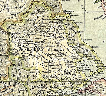
Glaphyrae (Ancient Greek: Γλαφυραί)[1] was a town of Magnesia in ancient Thessaly, mentioned by Homer in the Catalogue of Ships along with Boebe and Iolcus[2] After which, the name does not subsequently occur in history.[3] William Martin Leake wrote that the town is represented by the Hellenic ruins situated upon one of the hills above the modern village of (formerly called Kapourna), between Boebe and Iolcus.[4] This identification is accepted by modern scholars.[5][6] As of Leake's visit in the 19th century, the entire circuit of the citadel on the summit of the hill could be traced, and on its lower side part of the wall was still standing.[4]
References[]
- ^ Stephanus of Byzantium. Ethnica. s.v.
- ^ Homer. Iliad. 2.712.
- ^
 Smith, William, ed. (1854–1857). "Glaphyrae". Dictionary of Greek and Roman Geography. London: John Murray.
- ^ Jump up to: a b Leake, Northern Greece, vol. iv. p. 432.
- ^ Lund University. Digital Atlas of the Roman Empire.
- ^ Richard Talbert, ed. (2000). Barrington Atlas of the Greek and Roman World. Princeton University Press. p. 55, and directory notes accompanying.
![]() This article incorporates text from a publication now in the public domain: Smith, William, ed. (1854–1857). "Glaphyrae". Dictionary of Greek and Roman Geography. London: John Murray.
This article incorporates text from a publication now in the public domain: Smith, William, ed. (1854–1857). "Glaphyrae". Dictionary of Greek and Roman Geography. London: John Murray.
This article about a location in ancient Thessaly is a stub. You can help Wikipedia by . |
- Populated places in ancient Thessaly
- Former populated places in Greece
- Ancient Greek archaeological sites in Thessaly
- Locations in the Iliad
- Ancient Magnesia
- Ancient Thessaly geography stubs