Glems
| Glems | |
|---|---|
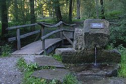 The Glemsbrunnen - source of the river Glems | |
| Location | |
| Country | Germany |
| Physical characteristics | |
| Source | |
| • location | Stuttgart |
| • elevation | 440 m (1,440 ft) |
| Mouth | |
• location | Enz |
• coordinates | 48°56′26″N 9°3′12″E / 48.94056°N 9.05333°ECoordinates: 48°56′26″N 9°3′12″E / 48.94056°N 9.05333°E |
• elevation | 188 m (617 ft) |
| Length | 47.0 km (29.2 mi) [1] |
| Basin size | 196 km2 (76 sq mi) [1] |
| Basin features | |
| Progression | Enz→ Neckar→ Rhine→ North Sea |

The river Glems is a right tributary of the river Enz in Baden-Württemberg, Germany and around 47 km (29 mi) long. The spring is located in the south-west of Stuttgart. On the way to the confluence into the Enz next to Unterriexingen (a quarter of Markgröningen) it passes the districts of Böblingen and Ludwigsburg.
The river Glems gives its name to a wooded mountain range called in the Böblingen district of Stuttgart Region.
References[]
| Authority control |
|---|
Categories:
- Tributaries of the Enz
- Rivers of Baden-Württemberg
- Rivers of Germany