Gmina Przemków
Gmina Przemków
Przemków Commune | |
|---|---|
 Coat of arms | |
 | |
| Coordinates (Przemków): 51°31′N 15°48′E / 51.517°N 15.800°ECoordinates: 51°31′N 15°48′E / 51.517°N 15.800°E | |
| Country | |
| Voivodeship | Lower Silesian |
| County | Polkowice |
| Seat | Przemków |
| Area | |
| • Total | 108.04 km2 (41.71 sq mi) |
| Population (2019-06-30[1]) | |
| • Total | 8,329 |
| • Density | 77/km2 (200/sq mi) |
| • Urban | 6,107 |
| • Rural | 2,222 |
| Website | http://przemkow.pl/ |

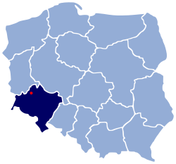
Gmina Przemków is an urban-rural gmina (administrative district) in Polkowice County, Lower Silesian Voivodeship, in south-western Poland. Its seat is the town of Przemków, which lies approximately 19 kilometres (12 mi) west of Polkowice, and 97 kilometres (60 mi) north-west of the regional capital Wrocław.
The gmina covers an area of 108.04 square kilometres (41.7 sq mi), and as of 2019 its total population is 8,329.
Neighbouring gminas[]
Gmina Przemków is bordered by the gminas of Chocianów, Gaworzyce, Gromadka, Niegosławice, Radwanice and Szprotawa.
Villages[]
Apart from the town of Przemków, the gmina contains the villages of Jakubowo Lubińskie, Jakubowo-Węgielin, Jędrzychówek, Karpie, Krępa, Łąkociny, Łężce, Ostaszów, Piotrowice, Szklarki, Wilkocin and Wysoka.
References[]
- ^ "Population. Size and structure and vital statistics in Poland by territorial division in 2019. As of 30th June". stat.gov.pl. Statistics Poland. 2019-10-15. Retrieved 2020-02-14.
| Town and seat |  | |
|---|---|---|
| Villages | ||
Seat: Polkowice | ||
| Urban-rural gminas |  | |
| Rural gminas | ||
This Polkowice County location article is a stub. You can help Wikipedia by . |
- Gminas in Lower Silesian Voivodeship
- Polkowice County
- Polkowice County geography stubs