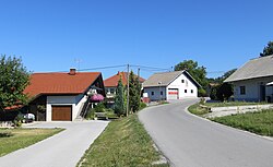
Gorenje Otave
Gorenje Otave | |
|---|---|
 | |
 Gorenje Otave Location in Slovenia | |
| Coordinates: 45°50′51.13″N 14°25′3.01″E / 45.8475361°N 14.4175028°ECoordinates: 45°50′51.13″N 14°25′3.01″E / 45.8475361°N 14.4175028°E | |
| Country | |
| Traditional region | Inner Carniola |
| Statistical region | Littoral–Inner Carniola |
| Municipality | Cerknica |
| Area | |
| • Total | 1.38 km2 (0.53 sq mi) |
| Elevation | 829 m (2,720 ft) |
| Population (2002) | |
| • Total | 41 |
| [1] | |

Gorenje Otave (pronounced [ɡɔˈɾeːnjɛ ɔˈtaːʋɛ]; German: Oberotawe[2][3]) is a village in the hills northeast of Begunje in the Municipality of Cerknica in the Inner Carniola region of Slovenia.[4]
Name[]
Gorenje Otave was attested as Sand Andre in 1499, in reference to Saint Andrew's Church in the village.[5] The name Gorenje Otave literally means 'upper Otave', contrasting with the name of neighboring Dolenje Otave (literally, 'lower Otave'). The name is probably derived from the Slovene common noun otava 'second crop (of hay)', referring to a meadow or area where hay could be harvested twice during the summer.[6]
History[]
An agricultural co-op building was built in Gorenje Otave in 1926, used by the villages to store farm equipment. During the Second World War, Italian forces shot 22 hostages in the village on 24 July 1942.[7]
Church[]

The local church in the settlement is dedicated to Saint Andrew and belongs to the Parish of Sveti Vid.[8] Stylistically it reflects 13th-century architecture; according to the parish chronicle, it was built in the 16th century.[7]
References[]
- ^ Statistical Office of the Republic of Slovenia
- ^ Leksikon občin kraljestev in dežel zastopanih v državnem zboru, vol. 6: Kranjsko. 1906. Vienna: C. Kr. Dvorna in Državna Tiskarna, p. 122.
- ^ Special-Orts-Repertorium von Krain. Vienna: Alfred Hölder. 1884. p. 96.
- ^ Cerknica municipal site
- ^ "Gorenje Otave". Slovenska historična topografija. ZRC SAZU Zgodovinski inštitut Milka Kosa. Retrieved August 2, 2020.
- ^ Snoj, Marko (2009). Etimološki slovar slovenskih zemljepisnih imen. Ljubljana: Modrijan. p. 297.
- ^ Jump up to: a b Savnik, Roman (1968). Krajevni leksikon Slovenije, vol. 1. Ljubljana: Državna založba Slovenije. p. 44.
- ^ Družina RC Church in Slovenia Journal website
External links[]
 Media related to Gorenje Otave at Wikimedia Commons
- Gorenje Otave on Geopedia
- Gorenje Otave cemetery at Find a Grave

- Populated places in the Municipality of Cerknica
- Cerknica geography stubs