Gossens
This article does not cite any sources. (September 2017) |
Gossens | |
|---|---|
 Coat of arms | |
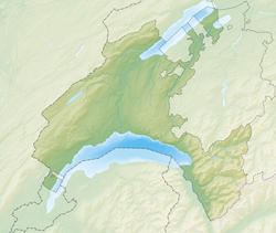
show Location of Gossens | |
 Gossens | |
| Coordinates: 46°44′N 06°42′E / 46.733°N 6.700°ECoordinates: 46°44′N 06°42′E / 46.733°N 6.700°E | |
| Country | Switzerland |
| Canton | Vaud |
| District | Yverdon |
| Area | |
| • Total | 1.02 km2 (0.39 sq mi) |
| Elevation | 538 m (1,765 ft) |
| Population (2003) | |
| • Total | 128 |
| • Density | 130/km2 (330/sq mi) |
| Time zone | UTC+01:00 (Central European Time) |
| • Summer (DST) | UTC+02:00 (Central European Summer Time) |
| Postal code(s) | 1407 |
| SFOS number | 5917 |
| Surrounded by | Bioley-Magnoux, Cronay, Donneloye, Orzens |
| Website | Profile (in French), SFSO statistics |


Gossens was a municipality in the district of Yverdon of the canton of Vaud in Switzerland. It merged with neighbouring Donneloye on January 1, 2008.
It is situated on the main road between Yverdon and Moudon. Its economy is mostly agricultural.
References[]
External links[]
| Wikimedia Commons has media related to Gossens. |
| Authority control |
|---|
This Vaud location article is a stub. You can help Wikipedia by . |
Categories:
- Former municipalities of the canton of Vaud
- Vaud geography stubs