Goudiry Department
Goudiry | |
|---|---|
 | |
| Country | |
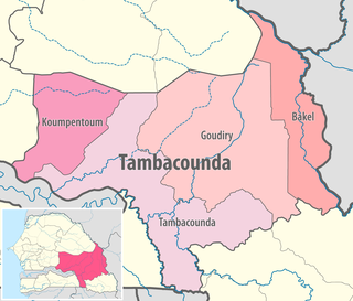
| Region | Tambacounda Region |
| Capital | Goudiry |
| Area | |
| • Total | 16,090 km2 (6,210 sq mi) |
| Population (2013 census) | |
| • Total | 114,847 |
| • Density | 7.1/km2 (18/sq mi) |
| Time zone | UTC±00:00 (GMT) |
Goudiry Department is one of the 45 departments of Senegal, one of four making up the Tambacounda Region. It was created by decree in 2008.
The department has two urban communes; Goudiry and .
The rest of the department is divided administratively into four arrondissements which are in turn divided into rural communities (communautés rurales).
- Bala Arrondissement:
- Bala
- Koar
- Goumbayel
- Boynguel Bamba Arrondissement:
- Boynguel Bamba
- Sinthiou Mamadou Boubou
- Koussan
- Dougué
- Dianké Makha Arrondissement:
- Dianké Makha
- Boutoucoufara
- Bani Israël
- Komoti
- Koulor Arrondissement:
- Koulor
- Sinthiou Bocar Ali
References[]
- ^ measuring area by google maps
Coordinates: 14°10′53″N 12°43′05″W / 14.18139°N 12.71806°W

This Senegal location article is a stub. You can help Wikipedia by . |
Categories:
- Departments of Senegal
- Tambacounda Region
- Senegal geography stubs