Gouin Dam
| Gouin Dam | |
|---|---|
 | |
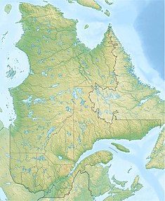 Location of Gouin Dam in Quebec | |
| Country | Canada |
| Location | Quebec, Mauricie, La Tuque |
| Coordinates | 48°21′12″N 74°05′57″W / 48.3533°N 74.0991°WCoordinates: 48°21′12″N 74°05′57″W / 48.3533°N 74.0991°W |
| Opening date | 1948 |
| Owner(s) | Hydro-Québec |
| Dam and spillways | |
| Type of dam | Gravity dam |
| Height (foundation) | 26 |
| Length | 502 |
| Dam volume | 178900 |
| [1] | |

The Gouin dam is a river infrastructure that created the Gouin Reservoir. This dam is the source of the Saint-Maurice River and is located in the town of La Tuque, in Mauricie, in province Quebec, in Canada.
Toponymy[]
The Gouin dam owes its name to Lomer Gouin (1861-1929), who was premier of Quebec between 1905 and 1920, federal minister of justice between 1921 and 1924 and Lieutenant Governor of Quebec in 1929.[2]
Geography[]
The Kikendatch Bay is formed by the Gouin dam which is located at:
- 4.4 km (2.7 mi) west of the mouth of the Wabano River (confluence with the Saint-Maurice River)
- 71.0 km (44.1 mi) south-east of the center of the village of Obedjiwan which is located on a peninsula on the north shore of Gouin Reservoir
- 55.3 km (34.4 mi) north-west of the center of the village of Wemotaci (north shore of the Saint-Maurice River)
- 142 km (88 mi) north-west of downtown La Tuque
- 252 km (157 mi) northwest of the mouth of the Saint-Maurice river (confluence with the St. Lawrence River at Trois-Rivières).[3]
Infrastructure[]
Completed in 1948, the dam is equipped with a mini-hydroelectric power station fitted with two turbine-generator sets of 300 kW each, in order to meet the needs of the dam itself, of the staff residences of Hydro-Québec assigned to its maintenance and an outfitter located nearby.
- Height of the dam: 26 metres (85 ft)
- Holding capacity: 27,795,000,000 m3 (9.816×10¹¹ cu ft)
- Height of the reservoir: 24.2 metres (79 ft)
- Length of the structure: 502 metres (1,647 ft)
- Type of dam: Concrete-gravity
- Type of foundation land: Roc. Class: A
- Level of consequences: Considerable
- Seismic zone: 1
- Reservoir area: 142.7 hectares (353 acres)
- Watershed area: 9,473 km2 (3,658 sq mi)[4]
See also[]
- Saint-Maurice River, a stream
- Gouin Reservoir, a body of water
- La Loutre Dam,
- Kikendatch Bay, one pass
References[]
- ^ "Barrage Gouin (Gouin Dam)". Centre d'expertise hydrique. Retrieved 2018-05-27.
Répertoire des barrages
. - ^ Bank of place names in Quebec. "Barrage Gouin". Commission de toponymie du Québec. Retrieved May 27, 2018..
- ^ Distances measured from l Atlas of Canada (published on the Internet) from the Department of Natural Resources Canada
- ^ Wikimapia - Accessed May 27, 2018
- Dams in Quebec
- La Tuque, Quebec
- Gouin Reservoir
- Buildings and structures in Mauricie