Greenstead Green and Halstead Rural
Greenstead Green and Halstead Rural | |
|---|---|
Civil parish | |
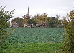 Greenstead Green church | |
| Coordinates: 51°56′04″N 0°39′12″E / 51.934349°N 0.65333093°ECoordinates: 51°56′04″N 0°39′12″E / 51.934349°N 0.65333093°E | |
| Country | England |
| Primary council | Braintree |
| County | Essex |
| Region | East of England |
| Halstead Rural | 1894 |
| Status | Parish |
| Main settlements | Greenstead Green, , and Whiteash Green |
| Area | |
| • Total | 17.71 km2 (6.84 sq mi) |
| Population (2011) | |
| • Total | 670 |
| • Density | 38/km2 (98/sq mi) |
| Website | https://www.greensteadgreenpc.org.uk/ |

Greenstead Green and Halstead Rural is a civil parish in the Braintree district, in the county of Essex, England. The parish includes the village of Greenstead Green and the hamlet of , and Whiteash Green. In 2011 the parish had a population of 670.[1] The parish touches Coggeshall, Colne Engaine, Earls Colne, Gosfield, Great Maplestead, Halstead, Little Maplestead, Pebmarsh, Sible Hedingham and Stisted[2] and surrounds the urban parish of Halstead.[3] There are 35 .[4]
History[]
On 31 December 1894 the parish was created from Halstead as Halstead Rural, on 1 October 1934 527 acres was transferred to Halstead Urban.[5] On 1 April 1974 it was renamed to "Greenstead Green and Halstead Rural".[6]
References[]
- ^ "Greenstead Green and Halstead Rural". City Population De. Retrieved 22 September 2021.
- ^ "Greenstead Green and Halstead Rural". Ordnance Survey. Retrieved 22 September 2021.
- ^ "Halstead Rural". British History Online. Retrieved 22 September 2021.
- ^ "Listed buildings in Greenstead Green and Halstead Rural, Braintree, Essex". British Listed Buildings. Retrieved 22 September 2021.
- ^ "Relationships and changes Halstead Rural CP through time". A Vision of Britain through Time. Retrieved 22 September 2021.
- ^ "Braintree Registration District". UKBMD. Retrieved 22 September 2021.
External links[]
| Wikimedia Commons has media related to Greenstead Green and Halstead Rural. |
This Essex location article is a stub. You can help Wikipedia by . |
- Civil parishes in Essex
- Braintree District
- Essex geography stubs