Greenstone and Caples Tracks
This article needs additional citations for verification. (May 2015) |
| Greenstone and Caples Tracks | |
|---|---|
 Lake Rere on the Greenstone Track | |
| Length | 61 km (38 mi) |
| Location | Fiordland National Park, New Zealand |
| Trailheads | Greenstone carpark, The Divide |
| Use | Tramping, Trail running |
| Elevation | |
| Highest point | 945 m (3,100 ft), McKellar Saddle |
| Lowest point | Greenstone carpark, 477 m (1,565 ft) |
| Hiking details | |
| Trail difficulty | medium |
| Season | Spring to Autumn (open all year) |
| Months | late October to mid April |
| Sights | Alpine views, lakes, forests, tussocklands, rivers |
| Hazards | Hypothermia, high winds, rocks, roots, snow, rain, avalanche |
| Surface | dirt, rock, roots |
| Website | Department of Conservation |
The Greenstone and Caples Tracks form a tramping (hiking) 61 kilometres (38 mi) circuit which is located in the South Island of New Zealand. Each track can be completed by itself and are linked by the McKellar Saddle[1] while the loop also links to several other tracks including the New Zealand Great Walk of the Routeburn Track as well as the Mavora Lakes Conservation Park tracks. All of these areas are part of the Te Wāhipounamu/South-West New Zealand World Heritage Area.
Ownership and access[]
The Caples Track follows the Caples River up the privately owned Caples Valley while the Greenstone Track follows the Greenstone River in the Greenstone Valley which is also privately owned. Much of the area is owned by the local tribe of the Ngāi Tahu while most of the tracks are in the with some also being a part of the Fiordland National Park around . The whole track is open to public access as long as stock is not disturbed.
Huts[]

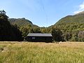
Greenstone Hut

McKellar Hut
Upper Caples Hut (private)


There are three public huts on the tracks, the Greenstone Hut, the McKellar Hut and the Mid Caples Hut. There are also several private huts as well as some hunters huts: The Mid Greenstone Hut and the Upper Caples Hut.[2]
Access to the Mavora Lakes Conservation Park is from the Greenstone Hut. Access to the Routeburn Track is near McKellar Hut.
References[]
- ^ "Greenstone & Caples". infotrack.co.nz. Info & Track. Retrieved 28 May 2015.
- ^ "Mid Greenstone Hut". southernlakesnzda.org.nz. NZDA Southern Lakes. Archived from the original on 13 April 2015. Retrieved 8 April 2015.

External links[]
| Wikimedia Commons has media related to Greenstone and Caples Tracks. |
Coordinates: 44°56′04″S 168°20′42″E / 44.93444°S 168.34500°E

This Fiordland, New Zealand geography article is a stub. You can help Wikipedia by . |
- Hiking and tramping tracks in Fiordland
- Protected areas of Southland, New Zealand
- Hiking and tramping tracks in New Zealand
- Fiordland geography stubs