Grenzaa
This article does not cite any sources. (September 2020) |
This article may be expanded with text translated from the corresponding article in German. (September 2011) Click [show] for important translation instructions.
|
| Grenzaa (German) Schoonebeker Diep (Dutch) | |
|---|---|
 | |
| Location | |
| Countries | Germany and Netherlands |
| State | Lower Saxony |
| Province | Drenthe |
| Physical characteristics | |
| Source | |
| • coordinates | 52°35′25″N 7°07′05″E / 52.59028°N 7.11806°E |
| • elevation | 20 m (66 ft) |
| Mouth | |
• coordinates | 52°39′00″N 6°46′21″E / 52.6501°N 6.7725°ECoordinates: 52°39′00″N 6°46′21″E / 52.6501°N 6.7725°E |
• elevation | 9 m (30 ft) |
| Basin features | |
| Progression | Vechte→ Zwarte Water→ IJsselmeer |
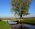
Grenzaa or Schoonebeker Diep is a river on the border of Lower Saxony, Germany and Drenthe, Netherlands, near the town Twist. It forms some of the border between the Netherlands and Germany. Through the and the it discharges into the Vechte near Coevorden.


See also[]
Categories:
- Tributaries of the Vechte
- Rivers of Drenthe
- Rivers of Lower Saxony
- Rivers of the Netherlands
- Rivers of Germany
- Germany–Netherlands border
- International rivers of Europe
- Border rivers
- Lower Saxony river stubs
- Europe river stubs
- Netherlands geography stubs