Grosthuizen
Grosthuizen | |
|---|---|
Hamlet | |
 Coat of arms | |
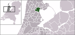 | |
 Grosthuizen in the municipality of Wester-Koggenland. | |
| Coordinates: 52°37′N 4°59′E / 52.617°N 4.983°ECoordinates: 52°37′N 4°59′E / 52.617°N 4.983°E | |
| Country | Netherlands |
| Province | North Holland |
| Municipality | Koggenland |
| Population | |
| • Total | 400 |
| Time zone | UTC+1 (CET) |
| • Summer (DST) | UTC+2 (CEST) |
| Postal code | 16xx |
| Dialing code | 0229 |
| Website | http://www.grosthuizen.nl |

Grosthuizen is a hamlet in the Dutch province of North Holland. It is a part of the municipality of Koggenland, and lies about 7 km southwest of Hoorn.
Grosthuizen was a separate municipality between 1817 and 1854, when it was merged with Avenhorn.[1]
The statistical area "Grosthuizen", which also can include the surrounding countryside, has a population of around 410.[2]
References[]
- ^ Ad van der Meer and Onno Boonstra, Repertorium van Nederlandse gemeenten, KNAW, 2011.
- ^ Statistics Netherlands (CBS), Statline: Kerncijfers wijken en buurten 2003-2005. As of 1 January 2005.
This North Holland location article is a stub. You can help Wikipedia by . |
Categories:
- Populated places in North Holland
- Former municipalities of North Holland
- Koggenland
- North Holland geography stubs