Guadalupe Municipality, Chihuahua
Guadalupe | |
|---|---|
 Guadalupe government headquarters | |
 Interactive map of Guadalupe Municipality | |
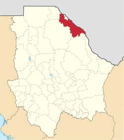 Municipality of Guadalupe in Chihuahua | |
| Coordinates: 31°23′23″N 106°06′05″W / 31.38972°N 106.10139°WCoordinates: 31°23′23″N 106°06′05″W / 31.38972°N 106.10139°W | |
| Country | |
| State | |
| Founded | 17 March 1855 |
| Named for | Our Lady of Guadalupe |
| Seat | Guadalupe |
| Largest city | Guadalupe |
| Area | |
| • Total | 6,200.5 km2 (2,394.0 sq mi) |
| Population (2010) | |
| • Total | 6,458 |

Guadalupe is one of the 67 municipalities of Chihuahua, in northern Mexico. The capital lies at Guadalupe. The municipality covers an area of 6,200.5 km².
As of 2010, the municipality had a total population of 6,458,[1]
Other than the town of Guadalupe, the municipality had 195 localities, none of which had a population over 1,000.[1]
Geography[]
Towns and villages[]
The municipality has 80 localities. The largest are:
| Name | 2010 Census Population |
|---|---|
| Guadalupe | 3,022 |
| Doctor Porfirio Parra | 956 |
| 788 | |
| 540 | |
| Rinconada del Mimbre | 539 |
| Total Municipality | 6,458 |
Adjacent municipalities and counties[]
- Ojinaga Municipality - southeast
- Coyame del Sotol Municipality - southeast
- Ahumada Municipality - south
- Juárez Municipality - west
- El Paso County, Texas - northwest
- Práxedis G. Guerrero Municipality - north
- Hudspeth County, Texas - north and northeast
- Jeff Davis County, Texas - east-southeast
- Presidio County, Texas - east- southeast
Crime[]
A narcofosa (mass grave attributed to organized crime) containing the remains of 13 people was discovered in Bravos in June 2018.[2]
References[]
- ^ a b "Guadalupe". Catálogo de Localidades. Secretaría de Desarrollo Social (SEDESOL). Retrieved 23 April 2014.
- ^ Villalpando, Rubén (January 11, 2021). "La Jornada - Con Corral, 10 mil 42 asesinatos en Chihuahua; 95%, impunes". jornada.com.mx (in Spanish). La Jornada. Retrieved January 11, 2021.
Places adjacent to Guadalupe Municipality, Chihuahua | |
|---|---|
Chihuahua (capital) | ||
| Cities |  | |
| Municipalities | ||
| Metropolitan areas | ||
| History |
| |
| Sights | ||
| Other topics | ||
Categories:
- Municipalities of Chihuahua (state)
- Chihuahua (state) populated places on the Rio Grande
- Chihuahua (state) geography stubs