Guderhandviertel
Guderhandviertel | |
|---|---|
 Flag  Coat of arms | |
Location of Guderhandviertel within Stade district 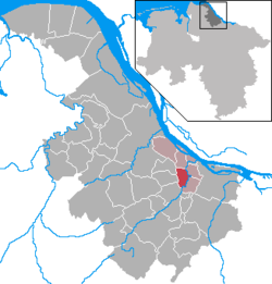 | |
 Guderhandviertel | |
| Coordinates: 53°33′N 9°37′E / 53.550°N 9.617°ECoordinates: 53°33′N 9°37′E / 53.550°N 9.617°E | |
| Country | Germany |
| State | Lower Saxony |
| District | Stade |
| Municipal assoc. | Lühe |
| Government | |
| • Mayor | Hans Gosch (CDU) |
| Area | |
| • Total | 8.93 km2 (3.45 sq mi) |
| Highest elevation | 2 m (7 ft) |
| Lowest elevation | 0 m (0 ft) |
| Population (2020-12-31)[1] | |
| • Total | 1,066 |
| • Density | 120/km2 (310/sq mi) |
| Time zone | UTC+01:00 (CET) |
| • Summer (DST) | UTC+02:00 (CEST) |
| Postal codes | 21720 |
| Dialling codes | 04142, 04163 |
| Vehicle registration | STD |
| Website | www.luehe-online.de |


Guderhandviertel is a municipality in the district of Stade, Lower Saxony, Germany.
It belonged to the Prince-Archbishopric of Bremen. In 1648 the Prince-Archbishopric was transformed into the Duchy of Bremen, which was first ruled in personal union by the Swedish and from 1715 on by the Hanoverian Crown. In 1823 the Duchy was abolished and its territory became part of the Stade Region.
References[]
This Stade (district) location article is a stub. You can help Wikipedia by . |
Categories:
- Municipalities in Lower Saxony
- Stade (district)
- Lüneburg region geography stubs