Gull River (Lake Nipigon)
| Gull River | |
|---|---|
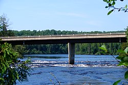 Gull River at Hwy 527 | |
 Location of the mouth of the Gull River in Ontario | |
| Etymology | From the Ojibwa name, gayaashk |
| Location | |
| Country | Canada |
| Province | Ontario |
| Region | Northwestern Ontario |
| District | Thunder Bay |
| Physical characteristics | |
| Source | Unnamed lake |
| • coordinates | 49°14′33″N 89°52′01″W / 49.24250°N 89.86694°W |
| • elevation | 494 m (1,621 ft) |
| Mouth | Lake Nipigon |
• coordinates | 49°49′14″N 89°05′19″W / 49.82056°N 89.08861°WCoordinates: 49°49′14″N 89°05′19″W / 49.82056°N 89.08861°W |
• elevation | 260 m (850 ft) |
| Basin features | |
| River system | Great Lakes Basin |

The Gull River is a river in Thunder Bay District in Northwestern Ontario, Canada.[1][2] The river is in the Great Lakes Basin and is a tributary of Lake Nipigon. The river's name is translated from the Ojibwa name, gayaashk.
Course[]
The river flows from an unnamed lake to Gull Bay on the western side of Lake Nipigon.[2] The river passes through Gull River 55 Indian Reserve of the Gull Bay First Nation, located on the south shore of Lake Nipigon.
History[]
Near the end of the 18th century, the Hudson's Bay Company established a fur trading post, Nipigon House, at Gull Bay.
See also[]
References[]
- ^ "Gull River". Geographical Names Data Base. Natural Resources Canada. Retrieved 2012-09-09.
- ^ a b "Gull River". Atlas of Canada. Natural Resources Canada. 2010-02-04. Retrieved 2012-09-09. Shows the river course highlighted on a topographic map.
Sources[]
- Map 13 (PDF) (Map). 1 : 1,600,000. Official road map of Ontario. Ministry of Transportation of Ontario. 2010-01-01. Retrieved 2012-09-09.
This article related to a river in Northern Ontario, Canada is a stub. You can help Wikipedia by . |
Categories:
- Rivers of Thunder Bay District
- Northern Ontario river stubs