Gunung Putri
Gunung Putri | |
|---|---|
Town | |
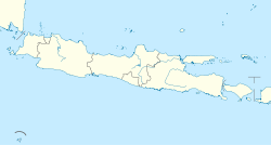
 Gunung Putri  Gunung Putri Gunung Putri (Java)  Gunung Putri Gunung Putri (Indonesia) | |
| Coordinates: 6°25′44″S 106°55′27″E / 6.428878°S 106.924119°ECoordinates: 6°25′44″S 106°55′27″E / 6.428878°S 106.924119°E | |
| Country | |
| Province | West Java |
| Regency | Bogor Regency |
| Government | |
| • Camat | Aris Pudjo Widyo Susanto |
| Area | |
| • Total | 60.87 km2 (23.50 sq mi) |
| Population (2020 Census) | |
| • Total | 298,084 |
| • Density | 4,900/km2 (13,000/sq mi) |
| Time zone | UTC+7 (IWST) |
| Area code | (+62) 251 |
| Vehicle registration | F |
| Villages | 10 |
| Website | kecamatangunungputri |
Gunung Putri is a district (Indonesian: Kecamatan) in the Bogor Regency, West Java, Indonesia, and is also part of the Jabodetabek metropolitan area (also known as Greater Jakarta). Because of its location, the district has earned itself a sizeably large population of commuters, and a high density of population.[1]
A bedroom community, Gunung Putri has a high density of population, compared to the other districts in the regency, with the district's northern part being a "planned community", complete with house complexes, parks, schools, and other facilities, all being designed and built by real estates.[2]
Apart from that, the central and southern portions of the district are also packed with houses, although the southern part centres more on being an industrial area.
Gallery[]

Entrance to one of the housing complexes

A mosque in Gunung Putri
References[]
- ^ "Website Resmi Kabupaten Bogor -Kecamatan Gunung Putri". bogorkab.go.id. Retrieved 2016-12-19.
- ^ "Kota Wisata Kota Sejuta Impian". kota-wisata.com. Retrieved 2016-12-19.
- Districts of Bogor Regency

