Guozha Lake
| Guozha Lake | |
|---|---|
| Kotra Tso | |
 Guozha Lake viewed from space | |
 Guozha Lake | |
| Location | Rutog County, Tibet, China |
| Coordinates | 35°1′53″N 81°5′11″E / 35.03139°N 81.08639°ECoordinates: 35°1′53″N 81°5′11″E / 35.03139°N 81.08639°E |
| Basin countries | China |
| Max. length | 30.4 km (19 mi) |
| Max. width | 11.6 km (7 mi) |
| Surface area | 252.6 km2 (100 sq mi) |
| Max. depth | 81.9 m (269 ft) |
| Shore length1 | 104 km (65 mi) |
| Surface elevation | 5,080 m (16,667 ft) |
| 1 Shore length is not a well-defined measure. | |

Kotra Tso (Tibetan: ཀོ་བཀྲ་མཚ),[1] also known as Guozha Lake (Chinese: 郭扎错),[a] and Lake Lighten,[2][b] is a glacial lake in Rutog County in the Ngari Prefecture in the northwest of the Tibet Autonomous Region of China. It lies in the western Kunlun Mountains to the northwest of Bangda Lake,[4] not far from the regional border with Xinjiang.[5] Located at an altitude of 5080 metres, it covers an area of 244 square kilometres with a maximum depth of 81.9 metres and his drainage basin contains 62 glaciers.[6]
India's claim line in Aksai Chin runs along the water-parting line of the Guozha lake and the Amtogor Lake to the west.[3] However, China has claimed the whole of Aksai Chin in 1959.
Maps[]
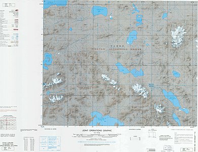
Map including LI-T'IEN HU (Lake Lighten)) (DMA, 1973)

Notes[]
References[]
- ^ Lake Kotra, kmaps.virginia.edu, retrieved 2021-07-03.
- ^ Michael Ward. The Kun Lun Shan: Desert Peaks of Central Asia, The Alpine Journal (1989-90), p. 90.
- ^ a b Lamb, Alastair (1973), The Sino-Indian Border in Ladakh (PDF), Australian National University Press, p. 10
- ^ Ehlers, Jürgen; Gibbard, Philip Leonard (15 July 2004). Quaternary Glaciations: South America, Asia, Africa, Australasia, Antarctica. Elsevier. p. 107. ISBN 978-0-444-51593-3. Retrieved 9 April 2012.
- ^ Maps (Map). Google Maps.
- ^ Chaohai, Liu; Shijie, Li; Yafeng, Shi (2017). "Glacial and lake fluctuations in the area of the west Kunlun mountains during the last 45 000 years". Annals of Glaciology. 16: 79–84. doi:10.3189/1992AoG16-1-79-84. ISSN 0260-3055.
| County-level divisions |  | |
|---|---|---|
| Towns and villages | ||
| Geography |
| |
| Landmarks | ||
This Ngari Prefecture, Tibet location article is a stub. You can help Wikipedia by . |
- Ngari Prefecture
- Lakes of Tibet
- Ngari Prefecture geography stubs