Haima, Oman
Haima | |
|---|---|
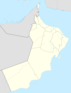 Haima Location in Oman | |
| Coordinates: 19°57′25″N 56°16′33″E / 19.95694°N 56.27583°E | |
| Country | |
| Region | Al Wusta Governorate (Oman) |
| Wilayat | Haima |

Haima (Arabic: هيماء), is a town in the central Oman.
It is the capital of the central region of Oman called Al Wusta Governorate.
Permanent settlement began after a team of oil explorers sunk a water well there. This well, along with another dug in al-Ajaiz, became the first permanent water sources in Jiddat il-Harasiis. The well in Haima was used less than that in al-Ajaiz on account of the poor grazing lands surrounding it.
In 1982 a school for boys and later one for girls was opened in Haima. Families from the Harasiis tribe have increasingly settled in this location while schools are in session. [1]
Climate[]
Haima has a hot desert climate (Köppen climate classification: BWh).
| Climate data for Haima | |||||||||||||
|---|---|---|---|---|---|---|---|---|---|---|---|---|---|
| Month | Jan | Feb | Mar | Apr | May | Jun | Jul | Aug | Sep | Oct | Nov | Dec | Year |
| Average high °C (°F) | 27.2 (81.0) |
29.6 (85.3) |
32.7 (90.9) |
39.3 (102.7) |
42.9 (109.2) |
44.1 (111.4) |
42.1 (107.8) |
42.1 (107.8) |
39.6 (103.3) |
36.6 (97.9) |
33.1 (91.6) |
28.9 (84.0) |
36.5 (97.7) |
| Daily mean °C (°F) | 19.8 (67.6) |
21.9 (71.4) |
25.1 (77.2) |
30.5 (86.9) |
34.1 (93.4) |
35.6 (96.1) |
35.1 (95.2) |
33.8 (92.8) |
31.7 (89.1) |
28.8 (83.8) |
25.6 (78.1) |
21.8 (71.2) |
28.7 (83.6) |
| Average low °C (°F) | 12.3 (54.1) |
14.1 (57.4) |
17.4 (63.3) |
21.6 (70.9) |
25.2 (77.4) |
27.1 (80.8) |
28.0 (82.4) |
25.4 (77.7) |
23.7 (74.7) |
21.0 (69.8) |
18.1 (64.6) |
14.6 (58.3) |
20.7 (69.3) |
| Average precipitation mm (inches) | 0.0 (0.0) |
0.0 (0.0) |
0.2 (0.01) |
2.5 (0.10) |
6.3 (0.25) |
1.4 (0.06) |
0.5 (0.02) |
0.6 (0.02) |
0.7 (0.03) |
0.0 (0.0) |
1.1 (0.04) |
0.4 (0.02) |
13.7 (0.55) |
| Source: http://www.world-climates.com/city-climate-haima-oman-asia/ | |||||||||||||
See also[]
References[]
- ^ Dawn Chatty, "Negotiating Authenticity and Translocality in Oman: The "Desertscapes" of the Harasiis Tribe," in Regionalizing Oman: Political, Economic and Social Dynamics," (ed) Steffen Wippel, New York: Springer, 2013, 137.
Coordinates: 19°57′25″N 56°16′33″E / 19.95694°N 56.27583°E
This article about the geography of Oman is a stub. You can help Wikipedia by . |
- Populated places in Oman
- Al Wusta Governorate (Oman)
- Oman geography stubs