Hamun-e Jaz Murian
| Lake Jaz Mourian | |
|---|---|
 Lake Jaz Mourian at wet season | |
 Lake Jaz Mourian | |
| Coordinates | 27°29′27″N 58°32′46″E / 27.4908°N 58.5461°ECoordinates: 27°29′27″N 58°32′46″E / 27.4908°N 58.5461°E |
| Type | Seasonal salt (hypersaline) lake |
| Primary inflows | Bampur River, Halil River |
| Primary outflows | none: all water entering the lake is lost through evaporation |
| Basin countries | Iran |
| Surface area | 3,300 km2 (1,300 sq mi) |
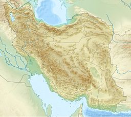
Hamun-e Jaz Murian (Persian: هامون جازموریان) is an inland basin or depression in southeast Iran, straddling the provinces of Kerman and Sistan and Baluchistan. The area of Hamoon and Jazmourian basin stretches to 69,600 square kilometers, with the western part of 35,600 square kilometers in Kerman province and the eastern part of 34,000 square kilometers in Sistan-Baluchestan province.
Jazmurian wetland is located in an endorheic basin at the southern edge of the Dasht-e-Lut. Several factors such as high evaporation, overexploitation of groundwater, dam construction on the rivers feeding the wetland, and the effect of drought and climate changes have caused this wetland to dry out during the recent years.
At the center of the basin is a "seasonal lake," or hamun. The lake can remain almost totally dry during dry years, while in wetter years it can have water year around. The most recent flooding of the basin took place in June 2007, when Cyclone Gonu dumped over 5 inches of rain over the basin. That ended years of unusual drought, which had seen the lake in the central basin remain dry for several years. Jaz Murian now has a large lake at its lowest point.
Jaz Murian is an oblong shape, east to west, surrounded by high mountain ranges reaching peaks in excess of 6500 feet (2000 m). The lowest elevations are to the extreme west of the basin towards the towns of Kahnuj and Minab.

Two principal rivers flow into the basin: from the west, the Halil Rud, and from the east, the Bampur River . However, neither river brings much water to the central parts of the basin to feed the lake, as their waters are largely or totally removed for agriculture on the way. After Jiroft Dam was built on the Halil Rud and went under operation in 1992, the perennial river at the downstream did not receive its environmental flow and appeared as an ephemeral river since then, this affected the Jaz Murian seriously.
Due to its isolation, distinct communities live in the basin, ranging from native Bashkardi speakers to immigrant Somalis.
In the scriptures of the Zoroastrian religion, the basin has a holy character, similar to that of Hamun-e Helmand. These scriptures call the basin by its Middle Persian name, "Chitro Mêyân."
References[]
- J. V. Harrison, "The Jaz Murian Depression, Persian Baluchistan," The Geographical Journal, Vol. 101, No. 5/6 (May - Jun., 1943), pp. 206–225.
- N. L. Falcon Frs, "From Musandam to the Iranian Makran," The Geographical Journal, Vol. 141, No. 1 (Mar., 1975), pp. 55–58.
- Depressions (geology)
- Endorheic basins of Asia
- Landforms of Iran
- Landforms of Kerman Province
- Landforms of Sistan and Baluchestan Province
