Hargicourt, Somme
Hargicourt | |
|---|---|
Part of Trois-Rivières | |
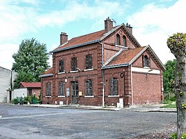 The old railway station in Hargicourt | |
show Location of Hargicourt | |
 Hargicourt | |
| Coordinates: 49°42′41″N 2°31′54″E / 49.7114°N 2.5317°ECoordinates: 49°42′41″N 2°31′54″E / 49.7114°N 2.5317°E | |
| Country | France |
| Region | Hauts-de-France |
| Department | Somme |
| Arrondissement | Montdidier |
| Canton | Roye |
| Commune | Trois-Rivières |
| Area 1 | 5.19 km2 (2.00 sq mi) |
| Population (2017)[1] | 403 |
| • Density | 78/km2 (200/sq mi) |
| Time zone | UTC+01:00 (CET) |
| • Summer (DST) | UTC+02:00 (CEST) |
| Postal code | 80500 |
| Elevation | 40–109 m (131–358 ft) (avg. 50 m or 160 ft) |
| 1 French Land Register data, which excludes lakes, ponds, glaciers > 1 km2 (0.386 sq mi or 247 acres) and river estuaries. | |


Hargicourt (French pronunciation: [aʁʒikuʁ]) is a former commune in the Somme department in Hauts-de-France in northern France. On 1 January 2019, it was merged into the new commune Trois-Rivières.[2]
Geography[]
Hargicourt is situated on the D483 road, some 16 miles (26 km) southeast of Amiens.
Population[]
| Year | 1962 | 1968 | 1975 | 1982 | 1990 | 1999 | 2006 |
|---|---|---|---|---|---|---|---|
| Population | 323 | 334 | 312 | 341 | 344 | 357 | 370 |
| From the year 1962 on: No double counting—residents of multiple communes (e.g. students and military personnel) are counted only once. | |||||||
See also[]
References[]
- ^ Téléchargement du fichier d'ensemble des populations légales en 2017, INSEE
- ^ Arrêté préfectoral 12 November 2018 (in French)
| Wikimedia Commons has media related to Hargicourt (Somme). |
| show Authority control |
|---|
Categories:
- Former communes of Somme (department)
- Populated places disestablished in 2019
- Montdidier arrondissement geography stubs