Harrismith Airport
hideThis article has multiple issues. Please help or discuss these issues on the talk page. (Learn how and when to remove these template messages)
|
Harrismith Airport | |||||||||||
|---|---|---|---|---|---|---|---|---|---|---|---|
| Summary | |||||||||||
| Airport type | Private | ||||||||||
| Location | Harrismith, Maluti-a-Phofung Local Municipality, Free State, South Africa | ||||||||||
| Elevation AMSL | 5,585 ft / 1,702 m | ||||||||||
| Coordinates | 28°14′06″S 029°06′23″E / 28.23500°S 29.10639°ECoordinates: 28°14′06″S 029°06′23″E / 28.23500°S 29.10639°E | ||||||||||
| Map | |||||||||||
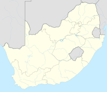 Harrismith Airport Location of Harrismith Airport in South Africa | |||||||||||
| Runways | |||||||||||
| |||||||||||

Harrismith Airport (IATA: HRS, ICAO: FAHR) is a small airfield near 42nd Hill in Free State, South Africa. It is located in Harrismith, halfway between Johannesburg and Durban. Although there are no commercial flights operating in or out of Harrismith, it is a zone for general aviation. It is along the N3 road and near the N5 road.[1]
Nearby places[]
See also[]
References[]
- ^ "Harrismith Airport". Harrismith.co. Archived from the original on 3 September 2012.
Categories:
- Airports in South Africa
- Transport in the Free State (province)
- Maluti-a-Phofung