Hartland Township, Kearny County, Kansas
Hartland Township | |
|---|---|
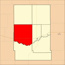 Location in Kearny County | |
| Coordinates: 38°00′33″N 101°25′55″W / 38.00917°N 101.43194°WCoordinates: 38°00′33″N 101°25′55″W / 38.00917°N 101.43194°W | |
| Country | United States |
| State | Kansas |
| County | Kearny |
| Area | |
| • Total | 149.73 sq mi (387.81 km2) |
| • Land | 149.69 sq mi (387.71 km2) |
| • Water | 0.04 sq mi (0.1 km2) 0.03% |
| Elevation | 3,307 ft (1,008 m) |
| Population (2000) | |
| • Total | 128 |
| • Density | 0.9/sq mi (0.3/km2) |
| GNIS feature ID | 0485278 |

Hartland Township is a township in Kearny County, Kansas, USA. As of the 2000 census, its population was 128.[1]
Geography[]
Hartland Township covers an area of 149.73 square miles (387.81 square kilometers); of this, 0.04 square miles (0.1 square kilometers) or 0.03 percent is water. The stream of Sand Creek runs through this township.
Unincorporated towns[]
- Hartland
(This list is based on USGS data and may include former settlements.)
Adjacent townships[]
- West Hibbard Township (north)
- East Hibbard Township (northeast)
- Lakin Township (east)
- Southside Township (southeast)
- Kendall Township (south)
- Kendall Township, Hamilton County (west)
Cemeteries[]
The township contains one cemetery, Hartland.
Major highways[]
References[]
- ^ "U.S. Census website". Retrieved 2008-06-24.
External links[]
Municipalities and communities of Kearny County, Kansas, United States | ||
|---|---|---|
| Cities |  | |
| Townships | ||
| ||
Categories:
- Townships in Kearny County, Kansas
- Townships in Kansas