Heel, Netherlands
Heel
Hael (Limburgish) | |
|---|---|
Village | |
 St. Stephanus church | |
 Flag | |
 | |
| Country | |
| Province | |
| Municipality | |
| Population (1 January 2015) | |
| • Total | 4,474 |
| Time zone | UTC+1 (CET) |
| • Summer (DST) | UTC+2 (CEST) |
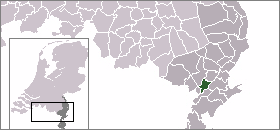
Heel (Dutch: [ɦeːl] (![]() listen); Limburgish: Hael) is a town and former municipality in the southeastern Netherlands. The town is located near the E25 motorway and the river Meuse.
listen); Limburgish: Hael) is a town and former municipality in the southeastern Netherlands. The town is located near the E25 motorway and the river Meuse.
History[]
In pre-Roman times, this was the location of the Gallic town of Catualium.[1]
In 1821, the municipality of Pol en Panheel, covering the village of Panheel and the hamlet , merged with Heel to form a municipality called Heel en Panheel.[2] In 1991, it was renamed simply Heel. On January 1, 2007, the municipality of Heel was merged into the municipality of Maasgouw.
Surrounding area[]
Major cities in the surrounding areas are;
- Roermond (Northeast, 10 kilometers)
- Maastricht (South, 45 kilometers)
- Eindhoven (Northwest, 50 kilometers)
Notable people[]
- Lies Visschedijk (born 1974), actress
- Jesse Huta Galung (born 1985), tennis player
External links[]
References[]
- ^ Willems, W.J.H. (1994). "Die villa rustica von Voerendaal (NL) und die ländliche Besiedlung". S.K. Palägy (Ed.),Forschungen und Ergebnisse. Internationale Tagung über römische Villen. 3 (May): 116–23. Retrieved 25 February 2013.
- ^ Ad van der Meer and Onno Boonstra, Repertorium van Nederlandse gemeenten, KNAW, 2011.
Coordinates: 51°10′N 5°53′E / 51.167°N 5.883°E

This Dutch Limburg location article is a stub. You can help Wikipedia by . |
Categories:
- Populated places in Limburg (Netherlands)
- Former municipalities of Limburg (Netherlands)
- Maasgouw
- Limburg (Netherlands) geography stubs