Heerewaarden
Heerewaarden | |
|---|---|
Village | |
 Flag  Coat of arms | |
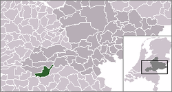 | |
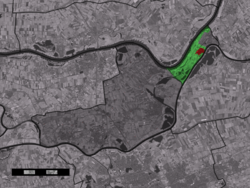 The village centre (red) and the statistical district (light green) of Heerewaarden in the municipality of Maasdriel. | |
| Coordinates: 51°49′N 5°23′E / 51.817°N 5.383°ECoordinates: 51°49′N 5°23′E / 51.817°N 5.383°E | |
| Country | Netherlands |
| Province | Gelderland |
| Municipality | Maasdriel |
| Population (1 January 2010) | |
| • Total | 1,463 |
| Time zone | UTC+1 (CET) |
| • Summer (DST) | UTC+2 (CEST) |
| Postal code | 6624 |
| Dialing code | 0487 |

Heerewaarden is a village in the Dutch province of Gelderland. It is a part of the municipality of Maasdriel, and lies about 8 km south of Tiel.
Heerewaarden was a separate municipality until 1999, except for a short period between 1818 and 1821, when it was part of Rossum.[1]
In 2001, the village of Heerewaarden had 980 inhabitants. The built-up area of the village was 0.28 km², and contained 417 residences.[2] The statistical area "Heerewaarden", which also can include the peripheral parts of the village, as well as the surrounding countryside, has a population of around 1250.[3]
References[]
- ^ Ad van der Meer and Onno Boonstra, Repertorium van Nederlandse gemeenten, KNAW, 2011.
- ^ Statistics Netherlands (CBS), Bevolkingskernen in Nederland 2001 Archived 2006-03-19 at the Wayback Machine. (Statistics are for the continuous built-up area).
- ^ Statistics Netherlands (CBS), Statline: Kerncijfers wijken en buurten 2003-2005. As of 1 January 2005.
External links[]
- J. Kuyper, Gemeente Atlas van Nederland, 1865-1870, "Heerewaarden". Map of the former municipality, abt. 1868.
| hide Authority control | |
|---|---|
| General |
|
| National libraries | |
This Gelderland location article is a stub. You can help Wikipedia by . |
Categories:
- Populated places in Gelderland
- Former municipalities of Gelderland
- Maasdriel
- Gelderland geography stubs