Helsa
Helsa | |
|---|---|
 Coat of arms | |
show Location of Helsa within Kassel district | |
 Helsa | |
| Coordinates: 51°16′N 09°41′E / 51.267°N 9.683°ECoordinates: 51°16′N 09°41′E / 51.267°N 9.683°E | |
| Country | Germany |
| State | Hesse |
| Admin. region | Kassel |
| District | Kassel |
| Government | |
| • Mayor (2020–26) | Andreas Schönemann[1] |
| Area | |
| • Total | 25.77 km2 (9.95 sq mi) |
| Elevation | 427 m (1,401 ft) |
| Population (2020-12-31)[2] | |
| • Total | 5,677 |
| • Density | 220/km2 (570/sq mi) |
| Time zone | UTC+01:00 (CET) |
| • Summer (DST) | UTC+02:00 (CEST) |
| Postal codes | 34298 |
| Dialling codes | 05605 (Helsa), 05602 (Eschenstruth, St. Ottilien), 05604 (Wickenrode) |
| Vehicle registration | KS |
| Website | www.gemeinde-helsa.de |
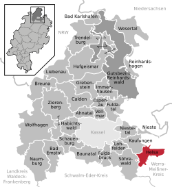


Helsa is a municipality and village in the district of Kassel, in Hesse, Germany. The municipality is situated in the Losse valley amongst the hills of the Kaufunger Wald, approx. 15 km east of Kassel.
Division of the municipality[]
The municipality consists of the villages, Eschenstruth (including Settlement Waldhof), Helsa, St. Ottilien and Wickenrode.
References[]
- ^ Direkt gewählte (Ober-) Bürgermeister/-innen der hessischen Städte und Gemeinden, accessed 6 July 2021.
- ^ "Bevölkerung in Hessen am 31.12.2020 nach Gemeinden". Hessisches Statistisches Landesamt (in German). June 2021.
External links[]
- Official site (in German)
| Authority control |
|---|
This Hesse location article is a stub. You can help Wikipedia by . |
Categories:
- Municipalities in Hesse
- Kassel (district)
- Hesse geography stubs