Heracleium (Pieria)
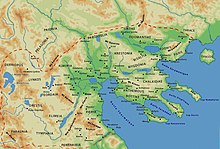
Map of Macedon
Heracleium or Herakleion (Ancient Greek: Ἡράκλειον) was a city on the south coast of ancient Pieria, Macedon, between Phila and Leibethra. During Peloponnesian war it passed into Athenian control in the years 430/29, 425/4 and 421 BCE. After Athenian alliance with Perdiccas II in 413 BCE it became again a city of Macedon.
The site of Heracleium is near the modern Platamon.[1][2]
References[]
- ^ Richard Talbert, ed. (2000). Barrington Atlas of the Greek and Roman World. Princeton University Press. p. 50, and directory notes accompanying.
- ^ Lund University. Digital Atlas of the Roman Empire.
- The Athenian Tribute Lists [1] by Benjamin D. Meritt
- An Inventory of Archaic and Classical Poleis [2] By Mogens Herman Hansen, Thomas Heine Nielsen
- Two Studies in Ancient Macedonian Topography - Page 46 by Miltiadēs V. Chatzopoulos, Louiza D. Loukopoulou
- CNN Transcript: Archaeologists Discover Ancient Cities Under Mediterranean
Coordinates: 39°58′N 22°38′E / 39.97°N 22.64°E

This article about a location in ancient Macedonia is a stub. You can help Wikipedia by . |
Categories:
- Geography of ancient Pieria
- Cities in ancient Macedonia
- Populated places in ancient Macedonia
- Former populated places in Greece
- Members of the Delian League
- Ancient Macedonia geography stubs