Hertsmere
Borough of Hertsmere | |
|---|---|
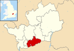 Hertsmere shown within Hertfordshire | |
| Sovereign state | United Kingdom |
| Constituent country | England |
| Region | East of England |
| Non-metropolitan county | Hertfordshire |
| Status | Non-metropolitan district, Borough |
| Admin HQ | Borehamwood |
| Incorporated | 1 April 1974 |
| Government | |
| • Type | Non-metropolitan district council |
| • Body | Hertsmere Borough Council |
| • Leadership | Leader & Cabinet (Conservative) |
| • MPs | Oliver Dowden |
| Area | |
| • Total | 39.06 sq mi (101.16 km2) |
| Area rank | 214th (of 309) |
| Population (mid-2019 est.) | |
| • Total | 104,919 |
| • Rank | 226th (of 309) |
| • Density | 2,700/sq mi (1,000/km2) |
| • Ethnicity | 88.9% White 4.7% S.Asian 2.5% Black 2.0% Mixed 1.8% Chinese or Other |
| Time zone | UTC0 (GMT) |
| • Summer (DST) | UTC+1 (BST) |
| ONS code | 26UE (ONS) E07000098 (GSS) |
| OS grid reference | TQ195975 |
| Website | www |

Hertsmere is a local government district and borough in Hertfordshire, England. Its council is based in Borehamwood. Other settlements in the borough include Bushey, Elstree, Radlett and Potters Bar. The borough borders the three north London boroughs of Harrow, Barnet and Enfield, and is located mainly within the M25 Motorway.
History[]
The district was formed on 1 April 1974, under the Local Government Act 1972, by a merger of the former area of Bushey Urban District and Potters Bar Urban District with Elstree Rural District and part of Watford Rural District (the parish of Aldenham). The Potters Bar Urban District (which coincided with the parish of South Mimms) was historically part of Middlesex, but had been transferred to Hertfordshire on 1 April 1965 when Greater London was created and Middlesex County Council abolished.
The name "Hertsmere" was invented for the new district by combining the common abbreviation of "Hertfordshire" ("Herts") with "mere", an archaic word for boundary. The name is doubly appropriate as the district straddles the historic county boundary between Middlesex and Hertfordshire and forms the administrative boundary between Hertfordshire and Greater London. The name is reflected in the council's coat of arms, which shows a hart upon the battlements of a boundary wall.
The district was awarded borough status on 15 April 1977.[1]
The borough was originally in the Metropolitan Police District, despite being outside the modern Greater London boundaries. It was transferred to Hertfordshire Constabulary in 2000.
Attractions[]
Hertsmere is the location of Elstree Film and TV Studios, which produces such shows as Strictly Come Dancing, Who Wants To Be A Millionaire, Dancing on Ice, and is the location for the Big Brother house. The studios were bought by Hertsmere Borough Council in 1996 and are operated via Elstree Film Studios Ltd.
Hertsmere is also the location for BBC Elstree Centre, the site of EastEnders, Holby City, and formerly the home to Top of the Pops, before its move to BBC TV Centre.
The area was also home to other TV and film studios, including MGM, until this was demolished for residential development, and is now an area called Studio Way.
Demographics[]
In the 2011 census, Hertsmere polled as the second most Jewish local authority in the United Kingdom, with Jews composing of one in seven residents (the highest being the North London borough of Barnet).[2]
Politics[]
The borough council currently consists of 39 elected councillors, with a third being elected at each election. As of the 2019 election there are 29 Conservative, 7 Labour and 3 Liberal Democrat councillors.[3]
Until 1983 the borough was included in the parliamentary constituency of Hertfordshire South. In 1983 the constituency was renamed Hertsmere.
Hertsmere had been represented in Parliament by Conservative, James Clappison since 1992. He succeeded Cecil Parkinson who had been Member of Parliament for the area since 1974. It is now represented by the Conservative, Oliver Dowden.
Parishes[]
The borough contains five parishes:
- Elstree and Borehamwood (Town)
- Aldenham
- Ridge
- Shenley
- South Mimms
Four parishes have parish councils[4] Ridge, which has fewer than 200 electors, is governed by a parish meeting following the dissolution of its parish council.[5]
The areas of the former Bushey and Potters Bar urban districts are unparished.
References[]
- ^ Department of the Environment (May 1977). Alterations of area and status of local authorities (PDF). Retrieved 4 December 2021.
Effective from 15 April 1977
- ^ Office for National Statistics 1 June 2006 accessed 1 January 2012
- ^ "Hertsmere Borough Council". BBC News Online. 13 May 2014. Retrieved 25 May 2014.
- ^ "Parish/Town Councils and Councillors". Hertsmere Council. Archived from the original on 17 May 2011. Retrieved 20 October 2011.
- ^ "Ridge Parish Council". St Giles’ Church, South Mymms and St Margaret’s Church, Ridge. Archived from the original on 25 April 2012. Retrieved 20 October 2011.
| Boroughs or districts |
|
|---|---|
| Major settlements |
|
| Topics |
|
Districts of the East of England | ||
|---|---|---|
| Bedfordshire |
|  |
| Cambridgeshire |
| |
| Essex |
| |
| Hertfordshire |
| |
| Norfolk |
| |
| Suffolk |
| |
Coordinates: 51°40′N 0°16′W / 51.66°N 0.27°W
| Wikimedia Commons has media related to Hertsmere. |
- Hertsmere
- Districts of Hertfordshire