Heukewalde
Heukewalde | |
|---|---|
 Coat of arms | |
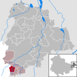
show Location of Heukewalde within Altenburger Land district | |
 Heukewalde | |
| Coordinates: 50°50′10″N 12°16′3″E / 50.83611°N 12.26750°ECoordinates: 50°50′10″N 12°16′3″E / 50.83611°N 12.26750°E | |
| Country | Germany |
| State | Thuringia |
| District | Altenburger Land |
| Municipal assoc. | Oberes Sprottental |
| Government | |
| • Mayor (2016–22) | Maik Piewak[1] |
| Area | |
| • Total | 5.89 km2 (2.27 sq mi) |
| Elevation | 275 m (902 ft) |
| Population (2020-12-31)[2] | |
| • Total | 191 |
| • Density | 32/km2 (84/sq mi) |
| Time zone | UTC+01:00 (CET) |
| • Summer (DST) | UTC+02:00 (CEST) |
| Postal codes | 04626 |
| Dialling codes | 034496 |
| Vehicle registration | ABG |
| Website | www.heukewalde.de |


Heukewalde is a German municipality in the Thuringian Landkreis of Altenburger Land. It belongs to the Verwaltungsgemeinschaft of Oberes Sprottental.
Geography[]
Neighboring Municipalities[]
Communities near Heukewalde include: Jonaswalde, Posterstein, and Vollmershain in the Landkreis of Altenburger Land; as well as Rückersdorf und Paitzdorf in the Landkreis of Greiz.
History[]
Heukewalde was first mentioned in writing on December 9, 1152. From 1826 to 1920, it belonged to Saxe-Altenburg.
Mayors[]
, mayor from 1892 to 1917.[citation needed]
External links[]
- (in German) A Heukewalde Chronicle (coat of arms)
| Wikimedia Commons has media related to Heukewalde. |
References[]
- ^ Gewählte Bürgermeister - aktuelle Landesübersicht, Freistaat Thüringen, accessed 14 July 2021.
- ^ "Bevölkerung der Gemeinden, erfüllenden Gemeinden und Verwaltungsgemeinschaften in Thüringen Gebietsstand: 31.12.2020". Thüringer Landesamt für Statistik (in German). June 2021.
| show Towns and municipalities in Altenburger Land |
|---|
| Authority control |
|---|
This Altenburger Land location article is a stub. You can help Wikipedia by . |
Categories:
- Municipalities in Thuringia
- Altenburger Land
- Duchy of Saxe-Altenburg
- Bezirk Leipzig
- Thuringia geography stubs