Highway M04 (Ukraine)
 | |
|---|---|
| Автошлях М04 | |
 | |
| Route information | |
| Part of | |
| Length | 566.9 km (352.3 mi) |
| Major junctions | |
| West end | |
| East end | Russian border at Izvaryne |
| Location | |
| Regions | Kropyvnytskyi region, Dnipropetrovsk Oblast, Donetsk Oblast, Luhansk Oblast |
| Highway system | |
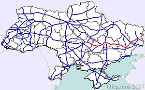
Highway M04 is a Ukraine international highway connecting Znamianka to Krasnodon on the border with Russia, where it continues into Russia as the A260.[1]
In Soviet times the M04 was part of the M21. Today the highway stretches through four oblasts and ends at the Izvaryne-Donetsk border checkpoint which is part of Krasnodon city (Luhansk Oblast). The section from Znamianka to Debaltseve is part of European route E50, and the section from Debaltseve to the Russian border is part of European route E40.
War in Donbas[]
In eastern Ukraine, significant armed conflict has occurred along and near the M04 in the Donetsk and Luhansk Oblasts during the War in Donbass.
Route[]
This article contains a bulleted list or table of intersections which should be presented in a properly formatted junction table. (November 2021) |
| Marker | Main settlements | Notes | Highway Interchanges |
|---|---|---|---|
| 0 km | Znamianka | ||
| Oleksandriia | |||
| Chapaivka | |||
| Dnipro | |||
| Donetsk | |||
| Debaltseve | |||
| Luhansk | |||
| 566 km | Izvaryne / Border (Russia) |
Gallery[]

M04 crossing Zhovta River near Piatykhatky, Dnipropetrovsk Oblast

See also[]
References[]
External links[]
- National Roads in Ukraine in Russian
This Ukrainian road or road transport-related article is a stub. You can help Wikipedia by . |
- Roads in Ukraine
- European route E40
- European route E50
- Roads in Dnipro
- Ukraine transport stubs
- Europe road stubs