Hiunchuli
| Hiunchuli | |
|---|---|
 Hiunchuli close up | |
| Highest point | |
| Elevation | 6,441 m (21,132 ft) |
| Prominence | c. 400 m (1,300 ft)[1] |
| Coordinates | 28°30′36″N 83°51′00″E / 28.51000°N 83.85000°ECoordinates: 28°30′36″N 83°51′00″E / 28.51000°N 83.85000°E |
| Geography | |
 Hiunchuli Location in Nepal | |
| Location | Nepal |
| Parent range | Himalayas |
| Climbing | |
| First ascent | October 1971 by an American Expeition |
| Easiest route | snow/rock climb |

Hiunchuli (Nepali: हिउँचुली) is a peak situated in the Annapurna massif of the Gandaki Province in north-central Nepal. The mountain is an extension of the Annapurna South. Between this peak and the Machapuchare is a narrow section of the valley that constitutes the sole access to the Annapurna Sanctuary.
Hiunchuli was first climbed in October 1971 by an expedition led by the U.S. Peace Corps volunteer Craig Anderson.[2] The mountain is classified as a trekking peak by the Nepal Mountaineering Association (NMA), but it is considered one of the more difficult trekking peaks to climb due to route finding difficulties and dangers from rock fall and seracs. A climbing permit from the NMA costs US$350 for a team of up to four members.
Gallery[]
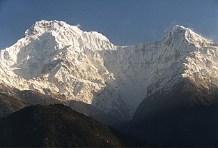
A view of Annapurna South and Hiunchuli
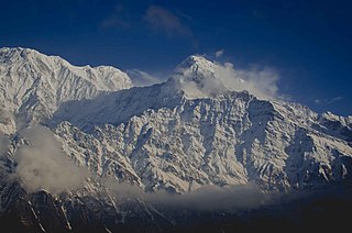
A view of Annapurna South and Hiunchuli from Mardi high camp
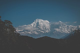
A view of Annapurna South and Hiunchuli from Australian base camp
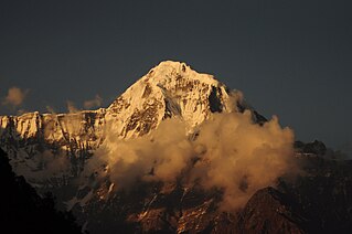
South face of Hiunchuli


References[]
- ^ Annapurna, 1:100,000 topographic map, Nelles Verlag, 1993.
- ^ "Asia, Nepal, Hiunchuli, Southeast Face".
{{cite web}}: CS1 maint: url-status (link)
This article related to a mountain or hill in Nepal is a stub. You can help Wikipedia by . |
- Mountains of the Gandaki Province
- Six-thousanders of the Himalayas
- Nepal mountain stubs