Hjälmaren
This article relies largely or entirely on a single source. (March 2015) |
| Hjälmaren | |
|---|---|
 | |
 Hjälmaren | |
 | |
| Coordinates | 59°15′N 15°45′E / 59.250°N 15.750°ECoordinates: 59°15′N 15°45′E / 59.250°N 15.750°E |
| Primary outflows | Eskilstunaån |
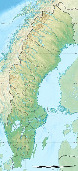
| Basin countries | Sweden |
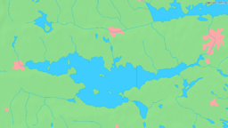
| Max. length | 58 km (36 mi)[1] |
| Max. width | 18 km (11 mi)[1] |
| Surface area | 483 km2 (186 sq mi)[1] |
| Average depth | 6.2 m (20 ft)[1] |
| Max. depth | 20 m (66 ft)[1] |
| Water volume | 3 km3 (2,400,000 acre⋅ft)[1] |
| Settlements | Örebro |
| References | [1] |

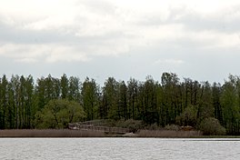
Hjälmaren (Swedish pronunciation: [ˈjɛ̂lːmarɛn] or [ˈjɛ̂lːmaɳ][2]), also spelled Jälmaren,[2] is Sweden's fourth largest lake. It is situated in the Central Swedish lowland and drains through Eskilstunaån into the adjacent Lake Mälaren, which in turn drains into the Baltic Sea, west of Stockholm. It is connected by waterway with Stockholm by the 13 kilometres long Hjälmare kanal.
It is bounded by the provinces of Södermanland, Närke, and Västmanland.
Hjälmaren is 63 kilometres long, about 20 kilometres wide, and has an average depth of 6 metres, and a surface of 483 km². The town of Örebro is situated at the western end of the lake. The lake itself is an iconic part of Sweden with music festivals taking place on the banks of the lake.[citation needed] Notable bands to play there are The Smashing Pumpkins, Sonic Youth and Pearl Jam.
1878 until 1887 the project lowered the surface level of Hjälmaren 1.3m to free up land for agriculture and to reduce the risk of flooding.
The rebel Engelbrekt Engelbrektsson, was assassinated in 1436 at , an islet in Lake Hjälmaren.
See also[]
- Lakes of Sweden
References[]
- ^ a b c d e f g "Vattenståndsmätningar i Hjälmaren" (PDF). Swedish Meteorological and Hydrological Institute. 2001. Archived from the original (PDF) on 2007-09-29. Retrieved 2009-01-03.
- ^ a b Jöran Sahlgren; Gösta Bergman (1979). Svenska ortnamn med uttalsuppgifter (in Swedish). p. 12.
| Wikimedia Commons has media related to Hjälmaren. |
- Norrström basin
- Lakes of Södermanland County
- Lakes of Stockholm County