Hoedekenskerke
Hoedekenskerke | |
|---|---|
Village | |
 Coat of arms | |
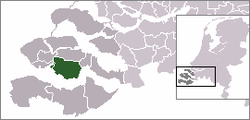 | |
 The village centre (dark green) and the statistical district (light green) of Hoedekenskerke in the municipality of Borsele. | |
| Coordinates: 51°25′27″N 3°54′45″E / 51.42417°N 3.91250°ECoordinates: 51°25′27″N 3°54′45″E / 51.42417°N 3.91250°E | |
| Country | Netherlands |
| Province | Zeeland |
| Municipality | Borsele |
| Population (1 January 2010) | |
| • Total | 724 |
| Time zone | UTC+1 (CET) |
| • Summer (DST) | UTC+2 (CEST) |

Hoedekenskerke is a village in the Dutch province of Zeeland. It is a part of the municipality of Borsele, and lies about 22 km east of Middelburg.
Hoedekenskerke was a separate municipality until 1970.[1]
In 2001, the village of Hoedekenskerke had 561 inhabitants. The built-up area of the town was 0.17 km², and contained 236 residences.[2] The statistical area "Hoedekenskerke", which also can include the peripheral parts of the village, as well as the surrounding countryside, has a population of around 740.[3]
References[]
- ^ Ad van der Meer and Onno Boonstra, Repertorium van Nederlandse gemeenten, KNAW, 2011.
- ^ Statistics Netherlands (CBS), Bevolkingskernen in Nederland 2001 Archived 2006-03-19 at the Wayback Machine. (Statistics are for the continuous built-up area).
- ^ Statistics Netherlands (CBS), Statline: Kerncijfers wijken en buurten 2003-2005. As of 1 January 2005.
External links[]
- J. Kuyper, Gemeente Atlas van Nederland, 1865-1870, "Hoedekenskerke". Map of the former municipality in 1868.
| Authority control |
|---|
This article about a location in Zeeland is a stub. You can help Wikipedia by . |
Categories:
- Populated places in Zeeland
- Former municipalities of Zeeland
- Borsele
- Zeeland geography stubs