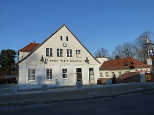
Hohen Neuendorf station
Hohen Neuendorf Hohen Neuendorf (b Berlin) | ||||||||||||||||
|---|---|---|---|---|---|---|---|---|---|---|---|---|---|---|---|---|
| Bf | ||||||||||||||||
 2012 | ||||||||||||||||
| Location | Schönfließer Straße 16 16540 Hohen Neuendorf Brandenburg Germany | |||||||||||||||
| Owned by | DB Netz | |||||||||||||||
| Operated by | DB Station&Service | |||||||||||||||
| Line(s) |
| |||||||||||||||
| Platforms | 1 island platform | |||||||||||||||
| Tracks | 2 | |||||||||||||||
| Train operators | S-Bahn Berlin | |||||||||||||||
| Connections | ||||||||||||||||
| Other information | ||||||||||||||||
| Station code | 2832 | |||||||||||||||
| DS100 code | BHN[1] | |||||||||||||||
| IBNR | 8080720 | |||||||||||||||
| Category | 5[2] | |||||||||||||||
| Fare zone | VBB: Berlin C/5154[3] | |||||||||||||||
| Website | www.bahnhof.de | |||||||||||||||
| History | ||||||||||||||||
| Opened | 1 September 1877 | |||||||||||||||
| Electrified | 5 June 1925 | |||||||||||||||
| Key dates | ||||||||||||||||
| 11 December 1924 | current building opened | |||||||||||||||
| Services | ||||||||||||||||
| ||||||||||||||||
 | ||||||||||||||||
| Location | ||||||||||||||||
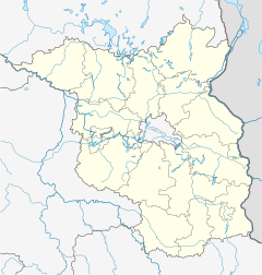 Hohen Neuendorf Location within Brandenburg | ||||||||||||||||
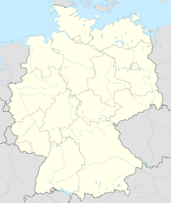

Hohen Neuendorf (in German S-Bahnhof Hohen Neuendorf) is a railway station in the town of Hohen Neuendorf, Germany. It is served by the Berlin S-Bahn and by several local buses.
On 13 August 1961, the S-Bahn line to Oranienburg was cut off by the Berlin Wall, and it was only from Hohen Neuendorf to Oranienburg as a shuttle and a lonely, not connected line. It was only connected on 19 November 1961 to the rest of the East Berlin S-Bahn. The West Berlin section from Hohen Neuendorf to Frohnau was later reconstructed since February 1991 and reopened on 31 May 1992. In addition, the southern exit from Hohen Neuendorf was also closed.
References[]
- ^ Eisenbahnatlas Deutschland (German railway atlas) (2009/2010 ed.). Schweers + Wall. 2009. ISBN 978-3-89494-139-0.
- ^ "Stationspreisliste 2021" [Station price list 2021] (PDF) (in German). DB Station&Service. 16 November 2020. Retrieved 3 December 2020.
- ^ "Der VBB-Tarif: Aufteilung des Verbundgebietes in Tarifwaben und Tarifbereiche" (PDF). Verkehrsbetrieb Potsdam. Verkehrsverbund Berlin-Brandenburg. 1 January 2017. Retrieved 25 November 2019.
External links[]
- Station information (in German)
Coordinates: 52°40′06″N 13°17′13″E / 52.6684°N 13.2870°E

This Berlin S-Bahn-related article is a stub. You can help Wikipedia by . |
This article about a railway station in Brandenburg is a stub. You can help Wikipedia by . |
- Berlin S-Bahn stations
- Railway stations in Brandenburg
- Buildings and structures in Oberhavel
- Railway stations in Germany opened in 1877
- Berlin S-Bahn stubs
- German railway station stubs
- Brandenburg building and structure stubs