Hohenfelde, Mecklenburg-Vorpommern
Hohenfelde | |
|---|---|
 Coat of arms | |
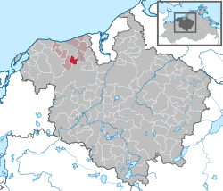
show Location of Hohenfelde within Rostock district | |
 Hohenfelde | |
| Coordinates: 54°4′N 11°55′E / 54.067°N 11.917°ECoordinates: 54°4′N 11°55′E / 54.067°N 11.917°E | |
| Country | Germany |
| State | Mecklenburg-Vorpommern |
| District | Rostock |
| Municipal assoc. | Bad Doberan-Land |
| Government | |
| • Mayor | Karlheinz Siewert |
| Area | |
| • Total | 9.43 km2 (3.64 sq mi) |
| Elevation | 49 m (161 ft) |
| Population (2020-12-31)[1] | |
| • Total | 785 |
| • Density | 83/km2 (220/sq mi) |
| Time zone | UTC+01:00 (CET) |
| • Summer (DST) | UTC+02:00 (CEST) |
| Postal codes | 18209 |
| Dialling codes | 038203 |
| Vehicle registration | LRO (old: DBR) |
| Website | www |


Hohenfelde (German pronunciation: [hoːənˈfɛldə] (![]() listen)) is a municipality in the Rostock district, in Mecklenburg-Vorpommern, Germany.
listen)) is a municipality in the Rostock district, in Mecklenburg-Vorpommern, Germany.
References[]
- ^ "Statistisches Amt M-V – Bevölkerungsstand der Kreise, Ämter und Gemeinden 2020". Statistisches Amt Mecklenburg-Vorpommern (in German). July 2021.
| show Towns and municipalities in Rostock (district) |
|---|
| Authority control |
|---|
This Rostock district location article is a stub. You can help Wikipedia by . |
Categories:
- Municipalities in Mecklenburg-Vorpommern
- Bezirk Rostock
- Rostock (district) geography stubs