Huglfing
Huglfing | |
|---|---|
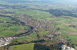 Huglfing from the south | |
 Coat of arms | |
show Location of Huglfing within Weilheim-Schongau district | |
 Huglfing | |
| Coordinates: 47°46′N 11°10′E / 47.767°N 11.167°ECoordinates: 47°46′N 11°10′E / 47.767°N 11.167°E | |
| Country | Germany |
| State | Bavaria |
| Admin. region | Upper Bavaria |
| District | Weilheim-Schongau |
| Government | |
| • Mayor (2020–26) | Markus Huber[1] |
| Area | |
| • Total | 24.36 km2 (9.41 sq mi) |
| Elevation | 606 m (1,988 ft) |
| Population (2020-12-31)[2] | |
| • Total | 2,933 |
| • Density | 120/km2 (310/sq mi) |
| Time zone | UTC+01:00 (CET) |
| • Summer (DST) | UTC+02:00 (CEST) |
| Postal codes | 82386 |
| Dialling codes | 08802 |
| Vehicle registration | WM |
| Website | www.huglfing.de |


Huglfing is a municipality in the Weilheim-Schongau district, in Bavaria, Germany.
References[]
- ^ Liste der ersten Bürgermeister/Oberbürgermeister in kreisangehörigen Gemeinden, Bayerisches Landesamt für Statistik, 15 July 2021.
- ^ "Tabellenblatt "Daten 2", Statistischer Bericht A1200C 202041 Einwohnerzahlen der Gemeinden, Kreise und Regierungsbezirke". Bayerisches Landesamt für Statistik (in German). June 2021.
| show Towns and municipalities in Weilheim-Schongau |
|---|
| Authority control |
|---|
This Weilheim-Schongau location article is a stub. You can help Wikipedia by . |
Categories:
- Municipalities in Bavaria
- Weilheim-Schongau
- Upper Bavaria geography stubs