Hum (Pešter)
| Hum | |
|---|---|
 | |
| Highest point | |
| Elevation | 1,756 m (5,761 ft)[1] |
| Coordinates | 42°57′51″N 20°07′16″E / 42.96417°N 20.12111°ECoordinates: 42°57′51″N 20°07′16″E / 42.96417°N 20.12111°E |
| Geography | |
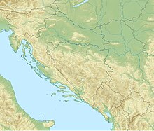
 Hum Location on the border of Serbia and Montenegro | |
| Location | Serbia / Montenegro |
| Parent range | Dinaric Alps |


Hum (Serbian Cyrillic: Хум) is a mountain on the border of Serbia and Montenegro, between towns of Sjenica and Rožaje, on the eastern edge of Pešter plateau. Its highest peak Krstača has an elevation of 1,756 meters above sea level.[2]
References[]
- ^ Jovan Đokić. "Katalog planina Srbije". PSD Kopaonik Beograd. Archived from the original on 2011-05-18.
- ^ "Prirodne karakteristike". Municipality of Sjenica.
This Serbia location article is a stub. You can help Wikipedia by . |
Categories:
- Mountains of Serbia
- Mountains of Montenegro
- Montenegro–Serbia border
- Serbia geography stubs