Hurley Glacier
From Wikipedia, the free encyclopedia
Glacier in Antarctica
| Hurley Glacier | |
|---|---|
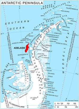 Location of Adelaide Island in the Antarctic Peninsula | |
 Location of Hurley Glacier in Antarctica | |
| Location | Adelaide Island |
| Coordinates |  67°34′S 68°32′W / 67.567°S 68.533°W / -67.567; -68.533 67°34′S 68°32′W / 67.567°S 68.533°W / -67.567; -68.533 |
| Thickness | unknown |
| Terminus | Ryder Bay |
| Status | unknown |
Hurley Glacier (67°34′S 68°32′W / 67.567°S 68.533°W / -67.567; -68.533Coordinates: WikiMiniAtlas67°34′S 68°32′W / 67.567°S 68.533°W / -67.567; -68.533) is a glacier between Mount Gaudry and Mount Liotard, flowing east into Ryder Bay, Adelaide Island, Antarctica. It was named by the UK Antarctic Place-Names Committee in 1977 after , a British Antarctic Survey mechanic at Halley Station, 1975–76, and Rothera Station, 1976–77.[1]
See also[]
- List of glaciers in the Antarctic
- Glaciology
References[]
- ^ "Hurley Glacier". Geographic Names Information System. United States Geological Survey. Retrieved 2012-07-05.
 This article incorporates public domain material from the United States Geological Survey document: "Hurley Glacier". (content from the Geographic Names Information System)
Portal: Geography
Adelaide Island | |||||||||
|---|---|---|---|---|---|---|---|---|---|
| Stations and bases |
| ||||||||
| Hills, peaks, and nunatuks |
| ||||||||
| Glaciers |
| ||||||||
| Other inland features |
| ||||||||
| Coastal features |
| ||||||||
| Off-shore |
| ||||||||
Glaciers in the Antarctic | |
|---|---|
|
Geography of West Antarctica | |
|---|---|
| Areas |
|
| Major ice shelves |
|
| Seas and major islands |
|
This Adelaide Island location article is a stub. You can help Wikipedia by . |
- v
- t
This article about a glacier in Graham Land is a stub. You can help Wikipedia by . |
- v
- t
Retrieved from ""
Categories:
- Glaciers of Adelaide Island
- Adelaide Island geography stubs
- Graham Land glacier stubs
Hidden categories:
- Articles with short description
- Short description matches Wikidata
- Coordinates on Wikidata
- Wikipedia articles incorporating text from the USGS Geographic Names Information System
- All stub articles