Hyattsville, Maryland
hideThis article has multiple issues. Please help or discuss these issues on the talk page. (Learn how and when to remove these template messages)
|
Hyattsville, Maryland | |
|---|---|
City | |
| City of Hyattsville | |
 Aerial view of Hyattsville | |
 Flag  Seal | |
| Nickname(s): Hyattsville | |
| Motto(s): "A World Within Walking Distance"[1] | |
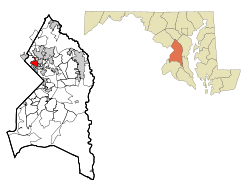 Location in Maryland | |
| Coordinates: 38°57′25″N 76°57′5″W / 38.95694°N 76.95139°WCoordinates: 38°57′25″N 76°57′5″W / 38.95694°N 76.95139°W | |
| Country | |
| State | |
| County | |
| Incorporated | 1886 |
| Government | |
| • Mayor | Kevin Ward (interim) |
| Area | |
| • Total | 2.70 sq mi (7.01 km2) |
| • Land | 2.68 sq mi (6.94 km2) |
| • Water | 0.03 sq mi (0.07 km2) |
| Elevation | 105 ft (32 m) |
| Population | |
| • Total | 17,557 |
| • Estimate (2019)[4] | 18,230 |
| • Density | 6,804.78/sq mi (2,627.60/km2) |
| Time zone | UTC−5 (Eastern) |
| • Summer (DST) | UTC−4 (Eastern) |
| Area code(s) | 301, 240 |
| FIPS code | 24-41250 |
| GNIS feature ID | 0597595 |
| Website | www.hyattsville.org |

Hyattsville is a city in Prince George's County, Maryland, United States,[5] and also a close, urban suburb of Washington, D.C. The population was 17,557 at the 2010 United States Census.[6]
History[]
Before Europeans reached the area, the upper Anacostia River was home to Nacotchtank/Anaquashtank people, a Piscataway-speaking Algonquian peoples who lived throughout what is now the Washington, D.C. area.[7] European encroachment and diseases decimated their population and by the 1680s the Nacotchtank/Anaquashtank had largely moved away and merged with other tribes. In the 1720s, John Beall acquired land in the area and established Beall Town, but the town did not prosper like its neighbor Bladensburg. The opening of the Washington–Baltimore Turnpike (modern day ![]() US 1) in 1812 and the B&O Railroad Washington Branch line in 1835 brought more settlers to the area.[8][9]
US 1) in 1812 and the B&O Railroad Washington Branch line in 1835 brought more settlers to the area.[8][9]
The city's founder, Christopher Clark Hyatt (1799–1884), purchased his first parcel of land in the area in 1845.[9] Hyatt opened a store and began mail delivery, officially naming the nascent community "Hyattsville" in his 1859 application to become postmaster. In the years following the Civil War, Hyatt and other local landowners subdivided their properties and sold lots, and the population of Hyattsville grew. Hyattsville was incorporated as a city on April 7, 1886.[10]
Revitalization projects[]
Since 2000, the city has undergone a major redevelopment, including significant residential and retail development in the Arts District Hyattsville (located in the Gateway Arts District]), and the area surrounding the Prince George's Plaza Metro station and The Mall at Prince Georges.[11] In the later area, University Town Center contains residential condos, student housing, office buildings, a public plaza, and retail space, including a 14-screen movie theater and several restaurants, as well as a campus of Prince George's Community College. As of 2020, additional residential and retail development is underway near the West Hyattsville Metro station.[12] Along Route 1, craft brewers and distillers have played a notable role in revitalizing old commercial properties.[13][14]
Geography[]
The City of Hyattsville consists of six subdivisions; Hyattsville Hills, Downtown Hyattsville, Kirkwood, Queens Chapel Manor, Castle Manor, and University Hills. Historic Hyattsville reportedly consists of the Hyattsville Hills, Downtown Hyattsville, and Castle Manor subdivisions.
According to the United States Census Bureau, the city has a total area of 2.70 square miles (6.99 km2), of which 2.67 square miles (6.92 km2) is land and 0.03 square miles (0.08 km2) is water.[15]
Climate[]
Typical of central Maryland, Hyattsville lies within the humid subtropical climate zone (Köppen: Cfa), characterized by hot humid summers and generally cool to mild winters, with high annual precipitation.[16] Hyattsville lies within USDA plant hardiness zone 7a.[17]
Demographics[]
| Historical population | |||
|---|---|---|---|
| Census | Pop. | %± | |
| 1880 | 288 | — | |
| 1890 | 1,509 | 424.0% | |
| 1900 | 1,222 | −19.0% | |
| 1910 | 1,917 | 56.9% | |
| 1920 | 2,675 | 39.5% | |
| 1930 | 4,264 | 59.4% | |
| 1940 | 6,575 | 54.2% | |
| 1950 | 12,308 | 87.2% | |
| 1960 | 15,168 | 23.2% | |
| 1970 | 14,998 | −1.1% | |
| 1980 | 12,709 | −15.3% | |
| 1990 | 13,864 | 9.1% | |
| 2000 | 14,733 | 6.3% | |
| 2010 | 17,557 | 19.2% | |
| 2019 (est.) | 18,230 | [4] | 3.8% |
| U.S. Decennial Census[18] | |||
Hyattsville has attracted a significant gay and lesbian population. In 2000, same-sex couples accounted for 1.3 percent of households, more than double the national average.[19]
2010 census[]
| Race | Population | % of Total |
|---|---|---|
| Total | 17,557 | 100 |
| African American | 6,258 | 35 |
| Hispanic | 5,972 | 34 |
| Caucasian | 5,826 | 33 |
| Other | 3,750 | 21 |
| Two or More Races | 807 | 4 |
| Asian | 768 | 4 |
| Native Americans | 139 | < 1% |
As of the census[3] of 2010, there were 17,557 people, 6,324 households, and 3,724 families residing in the city. The population density was 6,575.7 inhabitants per square mile (2,538.9/km2). There were 6,837 housing units at an average density of 2,560.7 per square mile (988.7/km2). The racial makeup of the city was 33.2% White, 35.6% African American, 0.8% Native American, 4.4% Asian, 0.1% Pacific Islander, 21.4% from other races, and 4.6% from two or more races. Hispanic or Latino of any race were 34.0% of the population (16.4% Salvadorean, 4.1% Mexican, 3.1% Guatemalan, 1.2% Honduran, 1.1% Dominican, 0.8% Puerto Rican).
There were 6,324 households, of which 33.2% had children under the age of 18 living with them, 36.4% were married couples living together, 15.7% had a female householder with no husband present, 6.8% had a male householder with no wife present, and 41.1% were non-families. 31.0% of all households were made up of individuals, and 6.7% had someone living alone who was 65 years of age or older. The average household size was 2.73 and the average family size was 3.39.
The median age in the city was 32.1 years. 22.2% of residents were under the age of 18; 12.6% were between the ages of 18 and 24; 34.7% were from 25 to 44; 23.2% were from 45 to 64; and 7.2% were 65 years of age or older. The gender makeup of the city was 50.8% male and 49.2% female.
2000 census[]
As of the census[21] of 2000, there were 14,733 people, 5,540 households, and 3,368 families residing in the city. The population density was 6,885.9 people per square mile (2,658.2/km2). There were 5,795 housing units at an average density of 2,708.5 per square mile (1,045.5/km2). The ethnic makeup of the city was 41.03% African American, 39.53% White, 18.14% Hispanic or Latino 0.50% Native American, 4.02% Asian, 0.04% Pacific Islander, 10.91% from other races, and 3.98% from two or more races.
There were 5,540 households, out of which 31.9% had children under the age of 18 living with them, 37.3% were married couples living together, 17.3% had a female householder with no husband present, and 39.2% were non-families. 30.6% of all households were made up of individuals, and 7.7% had someone living alone who was 65 years of age or older. The average household size was 2.59 and the average family size was 3.24.
In the city, the population was spread out, with 24.2% under the age of 18, 10.3% from 18 to 24, 34.0% from 25 to 44, 20.5% from 45 to 64, and 10.9% who were 65 years of age or older. The median age was 34 years. For every 100 females, there were 91.3 males. For every 100 females age 18 and over, there were 88.7 males.
The median income for a household in the city was $45,355, and the median income for a family was $51,625. Males had a median income of $33,163 versus $31,088 for females. The per capita income for the city was $20,152. About 7.9% of families and 10.8% of the population were below the poverty line, including 14.4% of those under age 18 and 8.4% of those age 65 or over.
Crime[]
The violent crime rate per 1,000 residents has significantly decreased, from 11.42 in 2007[22] to 5.59 in 2012.[23]
The city of Hyattsville has expressed concern that crime in non-Hyattsville locations sharing the same ZIP codes and unincorporated communities designated as "Hyattsville" by the United States Postal Service creates an image problem for the city.[24]
Arts and culture[]
Historic sites[]
The historic district of the city is home to a number of Victorian houses built in the late 1880s and Sears bungalows and Arts & Crafts houses built between the wars (late 1910s and early 1940s). Historic Hyattsville is roughly bounded by East West Highway to the north; Route 1 to the east; the 38th Street Neighborhood Park to the south, and Queens Chapel Road to the west.[25]
Some historic sites in Hyattsville are listed on the Maryland-National Capital Park and Planning Commission:[26] and the National Register of Historic Places. In 1982, a portion of the city was placed on the National Register of Historic Places as the Hyattsville Historic District; the district was extended in late 2004.
Notable historic sites include Hyattsville Armory and the Hyattsville Main Post Office.
Arts District[]
Downtown Hyattsville underwent revitalization in the early 2000s with the development of Arts District Hyattsville, part of the Gateway Arts District, a private project which includes townhomes, live-work units, and retail space.[27] The master developer of the 25-acre neighborhood was Bethesda-based EYA, and was constructed by EYA, Pulte Homes, StreetSense, and Bozzuto Homes. A Busboys and Poets restaurant opened in July 2011; other retail offerings include Yes! Organic Market, Elevation Burger, Chipotle Mexican Grill, Spice 6 Modern Indian, and Tara Thai.[28] In the winter of 2015, a traveling exhibition platform Visual Collaborative collaborated with the Arts District Hyattsville Master Association, utilizing the Lustine Center to host a group exhibition themed Vanity.[29]
Pyramid Atlantic Art Center, a nonprofit arts center is located in Hyattsville, in the historic Arcade building.[30][31]
Public libraries[]
Prince George's County Memorial Library System (PGCMLS) operates the Hyattsville Branch Library,[32] which in 1964 was the first county-built library building for PGCMLS.[33] The original mid-century modern building with its distinctive googie-style flying saucer entryway was demolished in 2019 after a failed effort by preservationists to have the building renovated instead of replaced.[34][35] The library system's administrative offices were housed in a building adjacent to the Hyattsville Branch[36] until they were moved to the Largo Library in Largo in 2015.[37]
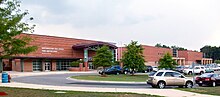
The Hyattsville Branch Library with its Googie flying saucer entrance[38] and Northwestern High School are also located in University Hills.
Government[]
When first incorporated, Hyattsville was run by a Board of Commissioners; in May 1900, it switched to a mayor and common council system. Today, the city government consists of a popularly elected mayor and a ten-person city council. Each of the five wards in the city are represented by two popularly elected councilmen.
In January 2015, the Hyattsville Council passed a charter amendment to allow 16- and 17-year-olds to vote in city elections, making Hyattsville one of the few jurisdictions in the United States that has done so.[39] In December 2016, the city expanded voting rights again, granting non-citizen residents the right to vote in municipal elections.[40]
Presidents of the Board of Commissioners[]
- Richard P. Evans (1886–87)
- Francis H. Smith (1887–89)
- Francis J. Gramlick (1889–90)
- Jackson H. Ralston (1890–91)
- Frederic A. Holden (1891–92)
- Jackson H. Ralston (1892–93)
- Francis H. Smith (1893–97)
- Michael V. Tierney (1897–98)
- L.K. Miller (1898–99)
- Charles E. Postley (1899–1900)
Mayors[]
- Gregory W. Eberwein (1898–00)
- Michael V. Tierney (1900–02)
- Charles A. Wells (1902–06)
- Joseph R. Owens (1906–08)
- John J. Fainter[a] (1908–09)
- William P. Magruder (1909–11)
- Roger Bellis (1911–12)
- Harry W. Shepherd (1912–14)
- Oswald A. Greagor (1914–15)
- Edward Devlin (1915–16)
- John G. Holden (1916–17)
- William A. Brooks (1917–19)
- Matthew F. Halloran (1919–20)
- T. Hammond Welsh (1920–21)
- J. Frank Rushe (1921–25)
- Irvin Owings (1925–27)
- Hillary T. Willis (1927–31)
- Lemuel L. Gray (1931–33)
- Hillary T. Willis (1933–38)
- E. Murray Gover (1938–46)
- R.T. Plitt[a] (1946–47)
- Caesar L. Aiello (1947–51)
- Jesse S. Baggett (1951–54)
- Thomas E. Arnold[a] (1954–55)
- George J. O'Hare (1955–59)
- Joseph F. Lilly (1959–67)
- Charles L. Armentrout (1967–75)
- George C. Harrison (1975–76)
- Jeremiah Harrington (1976–79)
- Thomas L. Bass (1979–95)
- Mary K. Prangley (1995–99)
- Robert W. Armentrout (1999–2003)
- William F. Gardiner (2003–11)
- Marc Tartaro (2011–15)
- Candace B. Hollingsworth (2015–20)
- Kevin Ward (2021– )
- ^ Jump up to: a b c acting mayor
County government[]
Prince George's County Police Department District 1 Station in Hyattsville serves areas outside of the city that are not located in an incorporated municipality that maintains its own police department.[41]
Federal government[]
The United States Postal Service operates Hyattsville Post Office,[42] the West Hyattsville Post Office,[43] and the Prince Georges Plaza Post Office.[44] The Calvert Carrier Annex has a Hyattsville address but is physically in Riverdale Park.[45]
The National Center for Health Statistics, part of the Department of Health and Human Services, is headquartered in Hyattsville and located at University Town Center.
Education[]
This section needs expansion. You can help by . (January 2018) |
Primary and secondary schools[]
Hyattsville Elementary, Felegy Elementary, Hyattsville Middle, and Northwestern High School, along with the Chelsea School, St. Matthews, DeMatha, and St. Jerome Academy are located within the city limits.
Public schools[]
The city is served by Prince George's County Public Schools,[46][47] and its borders overlap with the enrollment areas for the following public schools:[48][49][50]
- Hyattsville Elementary School
- Edward M. Felegy Elementary School
- Rosa Parks Elementary School
- University Park Elementary School
- Rogers Heights Elementary School
- Hyattsville Middle School
- Nicholas Orem Middle School
- William Wirt Middle School
- Northwestern High School
- Bladensburg High School
During the era of legally-required racial segregation of schools, black students from Hyattsville attended Lakeland High School in College Park in the period 1928-1950;[51] Fairmont Heights High School, then near Fairmount Heights, replaced Lakeland High and served black students only from 1950 to 1964; around 1964 legally-required racial segregation of schools ended.[52]
Private schools[]
- Chelsea School (5–12) for students with language-based learning disabilities and ADD/ADHD
- DeMatha Catholic High School (9–12)
- St. Francis International School (Catholic) (K–8) (St. Mark the Evangelist Campus) — As of 2013 it is primarily used for summer programs and athletics, with classes held in the Silver Spring campus.[53]
- Formerly St. Mark the Evangelist School,[54] closed and merged into Saint Francis International, which opened in 2010.[55] Beginning in 2013 College Park Academy (CPA) leased the St. Francis building;[53] in 2017 CPA moved to its permanent Riverdale Park campus.[56]
- St. Jerome Academy (Catholic) (Pre-K–8)
- St. Matthew's Parish Day School (Episcopal) (Pre-K–K)
Colleges and universities[]
Prince George's Community College has an extension center in University Town Center,[57]
Infrastructure[]
Transportation[]
Roads and highways[]
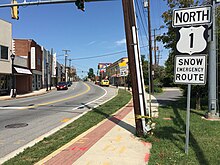
Several major surface highways serve Hyattsville. The most prominent of these is U.S. Route 1, which follows Rhode Island Avenue and Baltimore Avenue through the center of the city. US 1 connects southward to Washington, D.C. and northward through College Park to Interstate 95/Interstate 495 (the Capital Beltway). U.S. Route 1 Alternate follows the southern section of Baltimore Avenue to Bladensburg and provides an alternate route to Washington, D.C. Maryland Route 410 follows East-West Highway, connecting many of Washington, D.C.'s inner suburbs with Hyattsville. Two other state highways serving to connect Hyattsville to nearby towns include Maryland Route 208 and Maryland Route 500.
Public transportation[]
The Prince George's Plaza Metro station and West Hyattsville Metro station all serve Hyattsville. Hyattsville is also served by the Riverdale MARC commuter train station, as well as a few Metrobus and "The Bus" routes. Students and staff at the University of Maryland College Park have access to the free Shuttle UM Bus that goes from Historic Hyattsville to the University of Maryland College Park Campus.
Electric vehicles[]
In 2017, the Hyattsville City Police Department became the first law enforcement agency in the United States to put a Chevrolet Bolt (All-Electric) Fully Marked Police Patrol Vehicle into service. It has since added an All-Electric Police Motorcycle, and Six Public Electric Vehicle Charging Stations, which are free to use by the public.[58]
Notable people[]
- Joanne C. Benson, Maryland State Senator (District 24)
- Bill Butler, former Major League Baseball player
- Boris Kowerda, Russian White émigré assassin, monarchist and editor
- Parris Glendening, governor of Maryland from 1995–2003, began his political career as a member of Hyattsville City Council
- Arthur Frederick Goode III, child murderer who killed two children in the mid 1970s
- Anne Healey, Maryland House of Delegates (District 22)
- Robert B. Luckey, Marine Corps lieutenant general
- John C. Mather, Nobel laureate in physics
- Dorothy Hope Smith, illustrator of the famous Gerber Baby
- Alonzo T. Washington, Maryland House of Delegates (District 22)
- Paul Rabil, Major League Lacrosse player
- Frances Tiafoe, American tennis player
- Markelle Fultz, NBA player, graduate of DeMatha and first-overall selection of the 2017 NBA Draft
- Job Bartholomew Tate, politician from the state of Vermont.
- Chase Young, American football player, graduate of DeMatha[59]
- David Driskell, artist, scholar and curator[60]
In popular culture[]
The city was involved in a minor controversy in April 2006. In the episode airing April 27, the Geena Davis television series Commander in Chief depicted Hyattsville as having twelve murders in six months; it also indirectly depicted the city as being an urban ghetto dominated by poor minorities. The city and Prince George's County were very upset at ABC. On May 1, ABC formally apologized to both the city and county.[61]
Washington, D.C., based detective novelist George Pelecanos has included Hyattsville in some of his novels, including The Man Who Came Uptown.
References[]
- ^ "City of Hyattsville, Maryland". City of Hyattsville, Maryland. Retrieved August 25, 2012.
- ^ "2019 U.S. Gazetteer Files". United States Census Bureau. Retrieved July 25, 2020.
- ^ Jump up to: a b "U.S. Census website". United States Census Bureau. Retrieved January 25, 2013.
- ^ Jump up to: a b "Population and Housing Unit Estimates". United States Census Bureau. May 24, 2020. Retrieved May 27, 2020.
- ^ U.S. Geological Survey Geographic Names Information System: Hyattsville, Maryland
- ^ "Profile of General Population and Housing Characteristics: 2010 Demographic Profile Data (DP-1): Hyattsville city, Maryland". United States Census Bureau. Retrieved December 8, 2011.
- ^ "Native Peoples of Washington, DC". National Park Service. Retrieved February 22, 2020.
- ^ Schmidt, Kimberly (November 11, 2011). "Legend and Lore: A History of Hyattsville, Part 1". Hyattville Life & Times. Hyattsville, Maryland. Retrieved October 12, 2020.
- ^ Jump up to: a b Anacostia Trails Heritage Area — Part Two: Area and Site Analysis (PDF) (Report). p. 226. Retrieved October 12, 2020.
- ^ "Hyattsville History". City of Hyattsville, Maryland. Retrieved August 28, 2015.
- ^ "Celebrating Hyattsville: A Rebirth". Washington, D.C.: WRC-TV NBC4. July 8, 2014. Retrieved June 3, 2020.
- ^ Neibauer, Michael (December 9, 2019). "Metro to sell West Hyattsville land to the only developers who can build on it". Washington Business Journal. Washington, D.C. Retrieved June 3, 2020.
- ^ Teague Beckworth, Ryan (August 8, 2017). "Alchohol Fuels Once-Dry Hyattsville's Rebirth". The Hyattsville Wire. Hyattsville, MD. Retrieved June 3, 2020.
- ^ McLeod, Ethan (November 27, 2018). "Along D.C.'s Northeast Border, A Community of Brewers Is Booming". Washington, D.C.: WAMU-FM. Retrieved June 3, 2020.
- ^ "US Gazetteer files 2010". United States Census Bureau. Archived from the original on January 12, 2012. Retrieved January 25, 2013.
- ^ "Climate: Hyattsville". Climate-Data.org. Retrieved September 2, 2015.
- ^ "USDA Plant Hardiness Zone Map". United States Department of Agriculture. Archived from the original on February 27, 2014. Retrieved September 2, 2015.
- ^ "Census of Population and Housing". Census.gov. Retrieved June 4, 2015.
- ^ "Just Another Way to Be Suburban: In Pr. George's, Same-Sex Couples Grow in Number, Visibility," by Lonnae O'Neal Parker, The Washington Post, June 29, 2009.
- ^ "Hyattsville Maryland Population Statistics". US Census Bureau. Retrieved March 15, 2013.
- ^ "U.S. Census website". United States Census Bureau. Retrieved January 31, 2008.
- ^ "Universal Crime Rates, Table 8: Maryland". Federal Bureau of Investigation. 2007.
- ^ "Universal Crime Rates, Table 8: Maryland". Federal Bureau of Investigation. 2012.
- ^ "Community Legacy Revitalization Plan" (PDF). Archived from the original on May 3, 2004. Retrieved September 17, 2008.
- ^ Reinink, Amy. "It's old, but never old hat". The Washington Post. p. E6.
- ^ M-NCPPC Illustrated Inventory of Historic Sites (Prince George's County, Maryland), 2011.
- ^ "Gateway Arts District". MyGatewayArts. Retrieved August 28, 2020.
- ^ Gross, Daniel J (August 30, 2011). "New Organic Market Opening Furthers Hyattsville's Arts District Development". Gazette.net. Post-Newsweek Media Inc.
- ^ "R&B Singer TolumiDE Serenades Guests at Visual Collaborative 'VANITY' Event!". Ladybrille. December 17, 2015.
- ^ Andrew Metcalf (May 3, 2017). "Sherwin-Williams Moving Into Former Home of Pyramid Atlantic in Silver Spring". Bethesda Magazine. Retrieved January 28, 2021.
- ^ Marder, Andrew (June 8, 2015). "UPDATE: Pyramid Atlantic relocating to Hyattsville Arcade Building". Hyattsville Life & Times. Retrieved January 28, 2021.
has been located in downtown Silver Spring since 2003.
- ^ "Hyattsville Branch." Prince George's County Memorial Library System. Retrieved on February 1, 2018.
- ^ Bennett, Rebecca (June 26, 2014). "Hyattsville Library listed as endangered". Hyattsville Life & Times. Hyattsville, Maryland. Retrieved September 6, 2019.
- ^ Flynn, Katherine (January 24, 2014). "Save Our Saucer: The Fight to Protect a Space-Age Artifact in Hyattsville, Md". savingplaces.org. National Trust for Historic Preservation. Retrieved September 6, 2019.
- ^ Beckwith, Alison (April 2, 2019). "Demolition Begins at Hyattsville Library Site". The Hyattsville Wire. Hyattsville, Maryland. Retrieved September 6, 2019.
- ^ "Hyattsville." Prince George's County Memorial Library System. January 1, 2004. Retrieved on September 20, 2018. "Hyattsville Address: 6530 Adelphi Rd. Hyattsville, MD 20782 and "Administrative Offices : 6532 Adelphi Road, Hyattsville, MD 20782-209"
- ^ "Board of Library Trustees Meeting June 9, 2015–7:30 p.m. Oxon Hill Branch." Prince George's County Public Library. Retrieved on September 20, 2018. p. 2/5.
- ^ "Save Our Saucer: The Fight to Protect a Space-Age Artifact in Hyattsville, Md. | National Trust for Historic Preservation".
- ^ Bennett, Rebecca (January 6, 2015). "Council lowers Hyattsville voting age to 16 years old". Hyattsville Life & Times. Archived from the original on March 7, 2015.
- ^ Hernández, Arelis R. (December 7, 2016). "Hyattsville will allow non-U.S. citizens to vote in city elections". The Washington Post. Washington, D.C. Retrieved December 28, 2016.
- ^ "District 1 Station - Hyattsville. Prince George's County Police Department. Retrieved on September 9, 2018. Beat map.
- ^ "HYATTSVILLE." U.S. Postal Service. Retrieved on September 9, 2018. "4325 GALLATIN ST HYATTSVILLE, MD 20781-2051"
- ^ "WEST HYATTSVILLE." U.S. Postal Service. Retrieved on September 11, 2018. "3116 HAMILTON ST HYATTSVILLE, MD 20782-9997"
- ^ "PRINCE GEORGES PLAZA." U.S. Postal Service. Retrieved on September 11, 2018. "6525 BELCREST RD LBBY 180 HYATTSVILLE, MD 20782-9996"
- ^ "CALVERT CARRIER ANNEX." U.S. Postal Service. Retrieved on September 11, 2018. "6511 BALTIMORE AVE HYATTSVILLE, MD 20782-9998" - For the map of the municipality: "Maps Archived 2018-08-26 at the Wayback Machine." Town of Riverdale Park. Retrieved on March 3, 2018.
- ^ "Prince George's County Public Schools". Prince George's County Public Schools. Retrieved August 25, 2012.
- ^ Map. Hyattsville, Maryland. Retrieved on February 1, 2018.
- ^ "NEIGHBORHOOD ELEMENTARY SCHOOLS AND BOUNDARIES SCHOOL YEAR 2017-2018." Prince George's County Public Schools. Retrieved on January 31, 2018.
- ^ "NEIGHBORHOOD MIDDLE SCHOOLS AND BOUNDARIES SCHOOL YEAR 2017-2018." Prince George's County Public Schools. Retrieved on January 31, 2018.
- ^ "NEIGHBORHOOD HIGH SCHOOLS AND BOUNDARIES SCHOOL YEAR 2017-2018." Prince George's County Public Schools. Retrieved on January 31, 2018.
- ^ African-American Historic and Cultural Resources in Prince George's County, Maryland. Maryland-National Capital Park and Planning Commission, February 2012. p. 63 (document page 67). Retrieved on September 6, 2018.
- ^ "Fairmont Heights High School History". Fairmont Heights High School. September 4, 2018. Archived from the original on October 4, 2005. Retrieved September 4, 2018.
- ^ Jump up to: a b Weaver, Rosanna Landis (January 15, 2013). "Charter school to open in Hyattsville". . Retrieved September 6, 2018.
- ^ "St. Mark's School in Hyattsville holds reunion to marks its 50th year Archived 2018-09-06 at the Wayback Machine." Catholic Standard', Roman Catholic Archdiocese of Washington. Wednesday, October 15, 2008. Retrieved on January 31, 2018. "St. Mark Campus 7501 Adelphi Road Hyattsville, MD 20783"
- ^ Roberts, Tom. "Maryland Catholic school finds its footing amid demographic shifts." Catholic Standard', Roman Catholic Archdiocese of Washington. Wednesday, October 15, 2008. Retrieved on February 1, 2018.
- ^ Roscoe, Jack (October 4, 2017). "UMD celebrates College Park Academy's opening in Riverdale Park". The Diamondback. Retrieved September 6, 2018.
- ^ "PGCCC University Town Center Extension Center." Prince George's Community College. Retrieved on February 1, 2018.
- ^ https://www.youtube.com/watch?v=7MfeG3BDhbc&t=
- ^ Kepner, Tyler. "Who Is Chase Young? A Defensive Star and Student of the Game". New York Times. Retrieved April 22, 2020.
- ^ Genzlinger, Neil (April 7, 2020). "David Driskell, 88, Pivotal Champion of African-American Art, Dies". The New York Times. New York, New York. Retrieved July 17, 2021.
- ^ Berger, Judson (May 4, 2006). "TV show that portrayed Prince George's in unflattering light is canceled by network". The Gazette. Post Community Media LLC. Retrieved December 28, 2016.
External links[]
| Wikimedia Commons has media related to Hyattsville, Maryland. |
| Wikivoyage has a travel guide for Hyattsville. |
| show Places adjacent to Hyattsville, Maryland |
|---|
| show Municipalities and communities of Prince George's County, Maryland, United States |
|---|

| show Authority control |
|---|
- Hyattsville, Maryland
- Cities in Prince George's County, Maryland
- Washington metropolitan area
- Populated places established in 1845
- 1845 establishments in Maryland
- Cities in Maryland