Ibo (Mozambique)
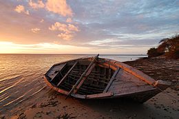 Sunset on the beach at Ilha do Ibo | |
 Ibo | |
| Geography | |
|---|---|
| Coordinates | 12°21′S 40°38′E / 12.350°S 40.633°ECoordinates: 12°21′S 40°38′E / 12.350°S 40.633°E |
| Archipelago | Quirimbas Islands |
| Adjacent bodies of water | Indian Ocean |
| Administration | |
Mozambique | |
| Province | Cabo Delgado |


Ibo is one of the Quirimbas Islands in the Indian Ocean off northern Mozambique. It is part of Cabo Delgado Province. It grew as a Muslim . Vasco da Gama reportedly rested on the island in 1502. The island was fortified in 1609 by the Portuguese.
In the late eighteenth century, Portuguese colonialists built the , which still survives, and the town, as a , became the second most important in the region after Mozambique Island. The island is now a far quieter place, known for its silversmiths.
During the war of independence against Portugal, many members of FRELIMO and other nationalist organisations were imprisoned and killed at the fort. The first president of independent Mozambique stated in 1983 that "Every palm tree on the island is fertilised by the bodies of the Mozambicans who were betrayed and killed by PIDE agents"[1]
Ibo forms part of the Quirimbas National Park and is linked by dhows to the mainland at .
In April 2019, Cyclone Kenneth hit the island and it was reported that 90% of the homes were destroyed.
References[]
- ^ Bertels, Ike. "Mozambique: Treatment for Traitors". National Institute of Cinema (Mozambique). Missing or empty
|url=(help)
External links[]
| Wikivoyage has a travel guide for Ibo Island. |
| Authority control |
|
|---|
This Mozambique location article is a stub. You can help Wikipedia by . |
- Quirimbas Islands
- Islands of Mozambique
- Geography of Cabo Delgado Province
- Mozambique geography stubs