Im Hinteren Eis
| Im Hinteren Eis | |
|---|---|
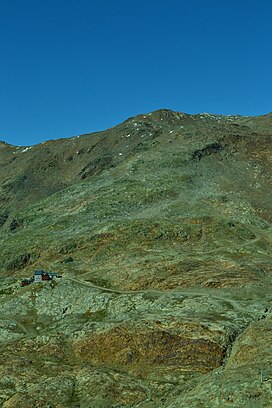 View of Im Hinteren Eis from the ascent to Grawand. | |
| Highest point | |
| Elevation | 3,270 m (10,730 ft) |
| Isolation | 0.58 km (0.36 mi) |
| Coordinates | 46°47′0″N 10°46′0″E / 46.78333°N 10.76667°ECoordinates: 46°47′0″N 10°46′0″E / 46.78333°N 10.76667°E |
| Geography | |
 Im Hinteren Eis | |
| Parent range | Ötztal Alps |

Im Hinteren Eis is a mountain in the Ötztal Alps on the border between Tyrol, Austria, and South Tyrol, Italy.
References[]
- Austrian Alpenverein (in German)
- Alpenverein South Tyrol (in German)
This Tyrol location article is a stub. You can help Wikipedia by . |
Categories:
- Mountains of the Alps
- Mountains of Tyrol (state)
- Mountains of South Tyrol
- Alpine three-thousanders
- Ötztal Alps
- Austria–Italy border
- International mountains of Europe
- Tyrol geography stubs