Inékar
Inékar | |
|---|---|
Cercle and village | |
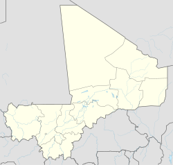 Inékar Location in Mali | |
| Coordinates: 15°56′57″N 3°9′33″E / 15.94917°N 3.15917°ECoordinates: 15°56′57″N 3°9′33″E / 15.94917°N 3.15917°E | |
| Country | |
| Region | Ménaka |
| Area | |
| • Total | 27,000 km2 (10,000 sq mi) |
| Population (2009 census)[2] | |
| • Total | 8,714 |
| • Density | 0.32/km2 (0.84/sq mi) |
| Time zone | UTC+0 (GMT) |

Inékar is a village and cercle of Ménaka Region in southeastern Mali.[3] It has an area of approximately 27,000 square kilometers and in 2009 had a population of 8,714.[2] It was previously a commune in Ménaka Cercle but was promoted to the status of a cercle when Ménaka Region was implemented in 2016.
References[]
- ^ Common and Fundamental Operational Datasets Registry: Mali, United Nations Office for the Coordination of Humanitarian Affairs, archived from the original on January 6, 2012. commune_mali.zip (Originally from the Direction Nationale des Collectivités Territoriales, Mali)
- ^ Jump up to: a b Resultats Recensement Général de la Population et de l’Habitat 2009 (Région de Gao) (PDF) (in French), République de Mali: Institut National de la Statistique, archived from the original (PDF) on 2011-07-22
- ^ "Première caravane de la paix dans la nouvelle région de Ménaka : la MINUSMA s'associe aux autorités régionales pour sa réussite" (in French). MINUSMA. 28 November 2016. Retrieved 25 May 2017.
External links[]
- Plan de Sécurité Alimentaire Commune Rurale de Inekar 2005-2009 (PDF) (in French), Commissariat à la Sécurité Alimentaire, République du Mali, USAID-Mali, 2005, archived from the original (PDF) on 2006-09-19.
- Situation des points d'eau modernes au Mali en 2003: Commune de Inekar, Ministère des Mines, de l'Energie et de l'Eau, République du Mali, 2003[dead link].
This Mali location article is a stub. You can help Wikipedia by . |
Categories:
- Populated places in Ménaka Region
- Cercles of Mali
- Mali geography stubs